24.4.3. ストリームのネットワーク解析
24.4.3.1. Connect down
For each zone in a raster entered (e.g. HUC converted to grid) it identifies the point with largest AreaD8. This is taken to be the outlet. A OGR file is created. Using flow directions each outlet is moved downflow a specified number of grid cells which is user controllable (Default is 1). The ID of the location the point has moved to is taken as iddown. Two OGR files are created one with the initial points and one with the moved points. Both contain id, iddown and AreaD8.
パラメーター
Label |
Name |
Type |
説明 |
D8 flow directions |
[raster] |
A grid of flow directions that are encoded using the D8 method where all flow from a cells goes to a single neighboring cell in the direction of steepest descent |
|
D8 contribution area |
[raster] |
A grid giving the contributing area value in terms of the number of grid cells (or the summation of weights) for each cell taken as its own contribution plus the contribution from upslope neighbors that drain in to it using the D8 algorithm. This is usually the output of the "D8 Contributing Area" tool. |
|
Watershed |
[raster] |
Watershed grid delineated from gage watershed function or streamreachwatershed function. Other watershed (e.g. HUC) raster also can be used as watershed grid. |
|
Grid cells move to downstream |
[number] |
Number of grid cells move to downstream based on flow directions. |
出力
Label |
Name |
Type |
説明 |
Outlets |
[vector: point] |
A point OGR file where each point is created from watershed grid having the largest contributing area for each zone. |
|
Moved Outlets |
[vector: point] |
A point OGR file defining moved outlets of interest. where each outlet is moved downflow a specified number of grid cells using flow directions. |
Python code
Algorithm ID: taudem:connectdown
import processing
processing.run("algorithm_id", {parameter_dictionary})
The algorithm id is displayed when you hover over the algorithm in the Processing Toolbox. The parameter dictionary provides the parameter NAMEs and values. See プロセシングアルゴリズムをコンソールから使う for details on how to run processing algorithms from the Python console.
24.4.3.2. D8エクストリーム上り坂値
D8流れモデルに基づいて、入力されたグリッドからの極端な(最大値または最小値のいずれか)上り勾配値を評価します。これは、最適な(分析をドロップによる)ストリームネットワークにつながる勾配時間領域産物の閾値を識別するために、ストリームラスター生成に使用するために最初に意図されています。
オプションの出口ポイントシェープファイルを使用する場合、出口セルとそれらの(D8フローモデルによる)セルの上り勾配だけが評価する領域です。
デフォルトでは、ツールはエッジ汚染をチェックします。これは、結果が原因カウントされていないドメインの外側のグリッドセルに過小評価される可能性として定義されます。排水は、標高のための「データなし」の値を持つ境界や領域から内側にある場合に発生します。このアルゴリズムは、これらのグリッドセルのための結果のために、このレポートと「データなし」を認識します。境界でドメインを入力流路に沿って境界から内側拡張「データなし」の値のすじを見るのが一般的です。これは、所望の効果であり、これらのグリッドセルのための結果が原因、それが利用可能なデータの領域の外側の地形に依存するまで不明であることを示しています。例えば、DEMが流域輪郭に沿ってクリップされている場合、エッジの汚染チェックは、これが問題でないと知っているか、これらの問題を無視したい場合はオフにできます。
パラメーター
Label |
Name |
Type |
説明 |
D8 Flow Directions Grid |
[raster] |
最も急な下り勾配とその8つの隣接または斜め近隣の一つの方向として、各セルのために、定義されたD8流れ方向のグリッド。このグリッドは 「D8流れ方向」 ツールの出力として得られます。 |
|
Upslope Values Grid |
[raster] |
これは、最大または最小の上り勾配値が選択された値のグリッドです。最も一般的に使用される値は、分析をドロップに係るストリームラスターを生成する際に必要な勾配時間領域の生成物です。 |
|
Outlets Shapefile Optional |
[vector: point] |
関心の出口を規定するポイントシェープファイル。この入力ファイルを使用すると、これらの店舗の上り勾配のエリアだけがツールによって評価されます。 |
|
Check for edge contamination |
[boolean] Default: True |
このツールがエッジ汚染についてチェックすべきかどうかを示すフラグ。 |
|
Use max upslope value |
[boolean] Default: True |
最大または最小上り勾配値を算出するかどうかを示すフラグ。 |
出力
Label |
Name |
Type |
説明 |
Extreme Upslope Values Grid |
[raster] |
最大/最小上り勾配値のグリッド。 |
Python code
Algorithm ID: taudem:d8flowpathextremeup
import processing
processing.run("algorithm_id", {parameter_dictionary})
The algorithm id is displayed when you hover over the algorithm in the Processing Toolbox. The parameter dictionary provides the parameter NAMEs and values. See プロセシングアルゴリズムをコンソールから使う for details on how to run processing algorithms from the Python console.
24.4.3.3. ゲージ流域
ゲージ流域グリッドを計算します。各グリッドセルは、それが他のゲージを通過せずに直接ドレインにゲージの識別子(カラムから id`)で標識されます。
パラメーター
Label |
Name |
Type |
説明 |
A suppr D-infinity flow directions |
|
[raster] |
A grid of flow directions based on the D-infinity flow method |
D8 Flow Directions Grid |
[raster] |
最も急な下り勾配とその8つの隣接または斜め近隣の一つの方向として、各セルのために、定義されたD8流れ方向のグリッド。このグリッドは 「D8流れ方向」 ツールの出力として得られます。 |
|
Gages Shapefile |
[vector: point] |
流域が描かれるゲージを定義するポイントシェイプファイル。このシェープファイルは列colmun |
出力
Label |
Name |
Type |
説明 |
Gage Watershed Grid |
[raster] |
グリッドは、各ゲージ流域を識別する。各グリッドセルは、それが他のゲージを通過せずに直接ドレインにゲージの識別子(列 |
|
Downstream Identifiers File |
[file] |
テキストファイル流域下り勾配の接続性を与えます |
Python code
Algorithm ID: taudem:gagewatershed
import processing
processing.run("algorithm_id", {parameter_dictionary})
The algorithm id is displayed when you hover over the algorithm in the Processing Toolbox. The parameter dictionary provides the parameter NAMEs and values. See プロセシングアルゴリズムをコンソールから使う for details on how to run processing algorithms from the Python console.
24.4.3.4. Length Area Stream Source
上り勾配経路長、D8寄与面積グリッド入力、およびパラメーター M と y に基づいて、 A>= (M)(Ly) を評価するインジケータ・グリッド(1, 0)を作成します。このグリッドは、おそらくストリームソースのグリッドセルを示しています。これは、ストリームの L〜0.6 をと述べハックの法則で理論的基礎と実験方法です。しかし平行流 L〜A とhillslopesため。だからhillslopesからストリームへの遷移は、 L ~ A 0.8 によって表すことができます、 A > M (L (1/0.8)) 場合、 ストリームセルとしてグリッドセルを同定示唆。
パラメーター
Label |
Name |
Type |
説明 |
Length Grid |
[raster] |
各セルの最大上り勾配の長さのグリッド。これは、各セルに排出遠いセルからの流路の長さとして算出されます。長さは、アカウントセルサイズに及び方向が隣接または斜めであるか否かをとるセルの中心間で測定されます。どのセルがストリーム・セルと見なされるか決定するために式 |
|
Contributing Area Grid |
[raster] |
D8のアルゴリズムを用いて計算した各セルの寄与面積値のグリッド。セルのための寄与の領域には、独自の寄与を加えたセルの数として測定され、それにドレインすべての上り勾配近隣からの寄与の和です。このグリッドは、通常、 「D8寄与エリア」 ツールの出力として得られます。このツールでは、ストリームへの移行を決定するための式 |
|
Threshold |
[number] Default: 0.03 |
ストリームの先頭を識別するために、式: |
|
Exponent |
[number] Default: 1.3 |
ストリームの開始を識別するために、式: |
出力
Label |
Name |
Type |
説明 |
Stream Source Grid |
[raster] |
インジケータグリッド(1,0)、A >= (M)(L^y)を評価、最大上り勾配経路長に基づいて、D8は、寄与する領域グリッド入力、およびパラメーター |
Python code
Algorithm ID: taudem:lengtharea
import processing
processing.run("algorithm_id", {parameter_dictionary})
The algorithm id is displayed when you hover over the algorithm in the Processing Toolbox. The parameter dictionary provides the parameter NAMEs and values. See プロセシングアルゴリズムをコンソールから使う for details on how to run processing algorithms from the Python console.
24.4.3.5. 出口を流れに移動する
流れラスタセルに揃っていない出口ポイントを、D8流れ方向に沿って下り傾斜で、流れラスターセルに遭遇するか、グリッドセルの「max_dist」数が検査されるか、または流れパスが領域を出る(すなわちD8流れ方向に対して「データなし」の値が遭遇する)まで移動。出力ファイルは新しい出口シェープファイルで、可能であれば各ポイントが流れラスターグリッドと一致するように移動されています。フィールド「dist_moved」が新しい出口シェープファイルに追加され、各ポイントに加えられた変更を示します。すでにストリームセルにあるポイントは移動せず、その "dist_moved"フィールドには値0が割り当てられます。流れセルに最初にないポイントは、次のいずれかが発生するまで、D8流れ方向に沿って下向きにスライドさせることによって移動されます。 a)グリッドセルの「max_dist」の数を走査する前に、流れラスターグリッドセルに遭遇する。この場合、ポイントは移動され、「dist_moved」フィールドには、ポイントが移動されたグリッドセルの数を示す値が割り当てられます。 b)グリッドセルの「最大番号」以上が横断される、またはc)横断が領域から外に出てしまう(すなわち、「データなし」D8流れ方向値に遭遇する)。この場合、ポイントは移動せず、「dist_moved」フィールドには値-1が割り当てられます。
パラメーター
Label |
Name |
Type |
説明 |
D8 Flow Direction Grid |
[raster] |
最も急な下り勾配とその8つの隣接または斜め近隣の一つの方向として、各セルのために、定義されたD8流れ方向のグリッド。このグリッドは 「D8流れ方向」 ツールの出力として得られます。 |
|
Stream Raster Grid |
[raster] |
この出力は、セルの残りのストリームセルの各々のための1と0の値を用いて、ストリームの位置を示すインジケータグリッド(1,0)です。このファイルは、 「ストリームネットワーク分析」 ツールセットで、いくつかの異なるツールによって生成されます。 |
|
Outlets Shapefile |
[vector: point] |
理想的には流れ上に配置されるべきであるが、原因シェープポイントの位置を正確に流れラスターグリッドに対して登録されていないかもしれないという事実に正確に流れ上でなくてもよい関心または出口の点を定義するポイントシェープファイル。 |
|
Maximum Number of Grid Cells to traverse |
[number] Default: 50 |
This input parameter is the maximum number of grid cells that the points in the input outlet shapefile will be moved before they are saved to the output outlet shapefile. |
出力
Label |
Name |
Type |
説明 |
Output Outlet Shapefile |
[vector: point] |
A point shape file defining points of interest or outlets. This file has one point in it for each point in the input outlet shapefile. If the original point was located on a stream, then the point was not moved. If the original point was not on a stream, the point was moved downslope according to the D8 flow direction until it reached a stream or the maximum distance had been reached. This file has an additional field "dist_moved" added to it which is the number of cells that the point was moved. This field is 0 if the cell was originally on a stream, -1 if it was not moved because there was not a stream within the maximum distance, or some positive value if it was moved. |
Python code
Algorithm ID: taudem:moveoutletstostreams
import processing
processing.run("algorithm_id", {parameter_dictionary})
The algorithm id is displayed when you hover over the algorithm in the Processing Toolbox. The parameter dictionary provides the parameter NAMEs and values. See プロセシングアルゴリズムをコンソールから使う for details on how to run processing algorithms from the Python console.
24.4.3.6. Peuker Douglas
Peukerとダグラスアルゴリズムに従って上方に湾曲したグリッドセルのインジケータグリッド(1,0)を作成します。
このツールで、DEMは、第1の中心、側面、及び対角線に重みでカーネルによって平滑化されます。Peukerおよびダグラス(1975)の方法(また、バンド、1986で説明)は、次いで、上方湾曲グリッドセルを識別するために使用されます。この技術フラグ全体のグリッドは、単一パスで4つのグリッドセルの各象限を調べ、最高unflags。フラグが立てられ、残りのセルは、「上方に湾曲した」とみなされる、と見たときに、チャンネルネットワークに似ています。このプロト・チャネル・ネットワークは、一般に、バンド(1986)により詳細に議論された問題の接続性を欠いており、間引きが必要です。
パラメーター
Label |
Name |
Type |
説明 |
Elevation Grid |
[raster] |
標高値のグリッド。これは通常 「ピット削除」 ツールの出力で、その場合にはピットが取り除かれた標高です。 |
|
Center Smoothing Weight |
[number] Default: 0.4 |
工具が上方に湾曲グリッドセルを識別する前に、DEMを滑らかにするためにカーネルが使用中央重みパラメーター。 |
|
Side Smoothing Weight |
[number] Default: 0.1 |
工具が上方に湾曲グリッドセルを識別する前に、DEMを滑らかにするためにカーネルが使用する側の重みパラメーター。 |
|
Diagonal Smoothing Weight |
[number] Default: 0.05 |
工具が上方に湾曲グリッドセルを識別する前に、DEMを滑らかにするためにカーネルが使用対角線重みパラメーター。 |
出力
Label |
Name |
Type |
説明 |
Stream Source Grid |
[raster] |
インジケータダグラスPeuker・アルゴリズムに従って上方に湾曲したグリッドセルのグリッド(1,0)、及び見れば水路ネットワークに似ています。このプロト水路ネットワークは、一般に、接続性を欠いており、間引きが必要です、バンド(1986)により詳細に議論された問題。 |
Python code
Algorithm ID: taudem:peukerdouglas
import processing
processing.run("algorithm_id", {parameter_dictionary})
The algorithm id is displayed when you hover over the algorithm in the Processing Toolbox. The parameter dictionary provides the parameter NAMEs and values. See プロセシングアルゴリズムをコンソールから使う for details on how to run processing algorithms from the Python console.
参照
Band, L. E., (1986), "数値標高モデルでのwatershedsのTopographic 分割", Water Resources Research, 22(1): 15-24.
Peuker、TKおよびド・ダグラス、(1975)、「離散的な地形標高データの局所的な並列処理による表面特異点の検出」、『計算グラフィックス画像処理』、 4: 375-387。
24.4.3.7. Peuker Douglas stream
Combines the functionality of the "Peuker Douglas", "D8 Contributing Area", "Stream Drop Analysis" and "Stream Definition by Threshold" tools in order to generate a stream indicator grid (1,0) where the streams are located using a DEM curvature-based method. With this method, the DEM is first smoothed by a kernel with weights at the center, sides, and diagonals. The Peuker and Douglas (1975) method (also explained in Band, 1986), is then used to identify upwardly curving grid cells. This technique flags the entire grid, then examines in a single pass each quadrant of 4 grid cells, and unflags the highest. The remaining flagged cells are deemed 'upwardly curved', and when viewed, resemble a channel network. This proto-channel network sometimes lacks connectivity, and/or requires thinning, issues that were discussed in detail by Band (1986). The thinning and connecting of these grid cells is achieved here by computing the D8 contributing area using only these upwardly curving cells. An accumulation threshold on the number of these cells is then used to map the channel network where this threshold is optionally set by the user, or determined via drop analysis.
If drop analysis is used, then instead of providing a value for the accumulation threshold, the accumulation threshold value is determined by searching the range between the Drop Analysis Parameters "Lowest" and "Highest", using the number of steps in the parameter "Number". For the science behind drop analysis, see Tarboton, et al. (1991, 1992), and Tarboton and Ames (2001). The value of accumulation threshold that is selected is the smallest value where the absolute value of the t-statistic is less than 2. This is written to the drop analysis table text file. Drop analysis is only possible when outlets have been specified, because if an entire grid domain is analyzed, as the threshold varies, shorter streams draining off the edge may not meet the threshold criterion and be excluded from the analysis. This makes defining drainage density problematic and it is somewhat inconsistent to compare statistics evaluated over differing domains.
パラメーター
出力
Label |
Name |
Type |
説明 |
Stream source |
[raster] |
インジケータダグラスPeuker・アルゴリズムに従って上方に湾曲したグリッドセルのグリッド(1,0)、及び見れば水路ネットワークに似ています。このプロト水路ネットワークは、一般に、接続性を欠いており、間引きが必要です、バンド(1986)により詳細に議論された問題。 |
Python code
Algorithm ID: taudem:peukerdouglasstreamdef
import processing
processing.run("algorithm_id", {parameter_dictionary})
The algorithm id is displayed when you hover over the algorithm in the Processing Toolbox. The parameter dictionary provides the parameter NAMEs and values. See プロセシングアルゴリズムをコンソールから使う for details on how to run processing algorithms from the Python console.
24.4.3.8. 傾斜と面積の組み合わせ
傾斜面積値 = (Sm) (An) 傾きと特定流域グリッド入力に基づいて、パラメーター m と n のグリッドを作成します。このツールは、傾斜面積ストリームラスター描写法の一部として使用するために意図されています。
パラメーター
Label |
Name |
Type |
説明 |
Slope Grid |
[raster] |
この入力は、勾配値のグリッドです。このグリッドは 「D無限流れ方向」 ツールから入手できます。 |
|
Contributing Area Grid |
[raster] |
独自の寄与(グリッドセルの長さまたは重みの総和)とし、各セルに加え、それに流れ出る登り近隣からの比例寄与のための特定の流域を与えるグリッド。このグリッドは、通常、 「D無限寄与エリア」 ツールから得られます。 |
|
Slope Exponent |
[number] Default: 2 |
式: |
|
Area Exponent |
[number] Default: 1 |
式: |
出力
Label |
Name |
Type |
説明 |
Slope Area Grid |
[raster] |
勾配面積値のグリッド= |
Python code
Algorithm ID: taudem:slopearea
import processing
processing.run("algorithm_id", {parameter_dictionary})
The algorithm id is displayed when you hover over the algorithm in the Processing Toolbox. The parameter dictionary provides the parameter NAMEs and values. See プロセシングアルゴリズムをコンソールから使う for details on how to run processing algorithms from the Python console.
24.4.3.9. Slope area stream definition
傾斜面積値 = (Sm) (An) 傾きと特定流域グリッド入力に基づいて、パラメーター m と n のグリッドを作成します。このツールは、傾斜面積ストリームラスター描写法の一部として使用するために意図されています。
パラメーター
Label |
Name |
Type |
説明 |
D8 flow directions |
[raster] |
||
D-infinity Contributing Area |
[raster] |
独自の寄与(グリッドセルの長さまたは重みの総和)とし、各セルに加え、それに流れ出る登り近隣からの比例寄与のための特定の流域を与えるグリッド。このグリッドは、通常、 「D無限寄与エリア」 ツールから得られます。 |
|
Slope |
[raster] |
この入力は、勾配値のグリッドです。このグリッドは 「D無限流れ方向」 ツールから入手できます。 |
|
Mask grid |
[raster] |
||
Outlets |
[vector: point] |
||
Pit-filled grid for drop analysis |
[raster] |
||
D8 contributing area for drop analysis |
[raster] |
||
Slope Exponent |
[number] Default: 2 |
式: |
|
Area Exponent |
[number] Default: 1 |
式: |
|
Accumulation threshold |
[number] |
||
Minimum threshold |
[number] |
||
Maximum threshold |
[number] |
||
Number of drop thresholds |
[number] |
||
Type of threshold step |
[enumeration] Default: 0 |
オプション:
|
|
Check for edge contamination |
[boolean] |
||
Select threshold by drop analysis |
[boolean] |
出力
Label |
Name |
Type |
説明 |
Stream raster |
[raster] |
||
Slope area |
[raster] |
勾配面積値のグリッド= |
|
Maximum upslope |
[raster] |
||
Drop analysis |
[file] |
Python code
Algorithm ID: taudem:slopeareastreamdef
import processing
processing.run("algorithm_id", {parameter_dictionary})
The algorithm id is displayed when you hover over the algorithm in the Processing Toolbox. The parameter dictionary provides the parameter NAMEs and values. See プロセシングアルゴリズムをコンソールから使う for details on how to run processing algorithms from the Python console.
24.4.3.10. しきい値により、ストリーム定義
Operates on any grid and outputs an indicator (1, 0) grid identifying cells with
input values >= the threshold value. The standard use is to use an accumulated
source area grid to as the input grid to generate a stream raster grid as the
output. If you use the optional input mask grid, it limits the domain being
evaluated to cells with mask values >= 0. When you use a D-infinity contributing
area grid (*sca) as the mask grid, it functions as an edge contamination
mask. The threshold logic is:
src = ((ssa >= thresh) & (mask >= s0)) ? 1:0
パラメーター
Label |
Name |
Type |
説明 |
Accumulated Stream Source Grid |
[raster] |
このグリッドは、名目上流域の特性のいくつかの特徴又は組み合わせを蓄積します。正確な特性(複数可)が使用されているストリーム・ネットワーク・ラスター化アルゴリズムに依存して変化します。このグリッドは、結果として生じたストリームネットワークが連続的であるようにグリッドセルの値が単調、D8の流れ方向に沿って下り勾配が増加している性質を有する必要があります。このグリッドは、蓄積からしばしばあるが、そのような最大上り勾配の関数として他の供給源はまた、適切なグリッドを生成します。 |
|
Threshold |
[number] Default: 100 |
セルはストリームセル考慮すべきかどうかを判断するために( |
|
Mask Grid Optional |
[raster] |
このオプションの入力は、対象と出力の領域をマスクするために使用されるグリッドにのみ、このグリッドは、この入力の一般的な使用は、そのようにマスクとしてD-無限寄与領域グリッドを使用する> = 0である場合に提供されています描写ストリームネットワークは、エッジ汚染マスクの機能を複製、D-無限寄与領域が利用可能である領域に拘束されています。 |
出力
Label |
Name |
Type |
説明 |
Stream Raster Grid |
[raster] |
これは、セルの残りの流れセルの各々のための1と0の値を用いて、流れの位置を示しているインジケーターグリッド(1,0)です。 |
Python code
Algorithm ID: taudem:threshold
import processing
processing.run("algorithm_id", {parameter_dictionary})
The algorithm id is displayed when you hover over the algorithm in the Processing Toolbox. The parameter dictionary provides the parameter NAMEs and values. See プロセシングアルゴリズムをコンソールから使う for details on how to run processing algorithms from the Python console.
24.4.3.11. Stream definition with drop analysis
Combines the function of the "Stream Drop Analysis" tool and the "Stream Definition by Threshold" tools.
It applies a series of thresholds (determined from the input parameters) to
the input accumulated stream source grid (ssa) grid and outputs the results
in the stream drop statistics table (drp.txt). Then it outputs a stream raster grid,
which is an indicator (1,0) grid of stream cells. Stream cells are defined as those cells
where the accumulated stream source value is >= the optimal threshold as determined
from the stream drop statistics.
There is an option to include a mask input to replicate the functionality for using
the *sca file as an edge contamination mask.
The threshold logic should be: src = ((ssa >= thresh) & (mask >=0)) ? 1:0
パラメーター
出力
Python code
Algorithm ID: taudem:streamdefdropanalysis
import processing
processing.run("algorithm_id", {parameter_dictionary})
The algorithm id is displayed when you hover over the algorithm in the Processing Toolbox. The parameter dictionary provides the parameter NAMEs and values. See プロセシングアルゴリズムをコンソールから使う for details on how to run processing algorithms from the Python console.
24.4.3.12. 流れ落下解析
( *ssa )入力蓄積流れソースグリッドに(入力パラメーターから決定される)閾値の一連を適用しグリッドとで結果を *drp.txt ファイルに流れドロップ統計表に出力します。この関数は、流れを描写するために使用される、地形的に客観的な閾値の決定を支援するために設計されています。ドロップ分析しきい値の範囲の流れネットワークを評価し、得られたストラーの一定落下プロパティ流れを調べることによって、自動的に適切な閾値を選択することを試みます。基本的には質問をする:T検定を使用してより高次の流れの平均流れ落下統計的に異なる一次流れの平均流れの低下です。流れ降下が同じ流れ順序のリンクのシーケンスとして定義される流れの開始から終了までの高低差です。T検定が有意差を示した場合、流れネットワークはこの「法則」に従わないので、より大きなしきい値を選択する必要があります。T検定は、有意な差を示さないための最小閾値が地形から一定ストリームドロップ「法則」に従う最高解像度流れネットワークを与え、閾値がより「目標」または流れの自動図化のために選択されますDEM。この関数は、蓄積流れソースグリッドに蓄積された正確な流域特性(複数可)は、流れネットワーク・ラスターを決定するために使用されている方法に基づいて変化流れネットワークラスターの開発に使用できます。
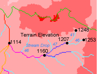
流れ落下一定の「法則」はBroscoe(1959)により確認されました。ストリーム描写の閾値を決定するためにこれを使用することの背後にある科学については、Tarbotonら(1991、1992)、Tarbotonとエイムズ(2001)を参照。
パラメーター
Label |
Name |
Type |
説明 |
D8 Contributing Area Grid |
[raster] |
D8のアルゴリズムを用いて計算した各セルの面積値を寄与のグリッド。セルのための寄与の領域には、独自の寄与を加えたセルの数や重量負荷の合計として測定され、それに流れるすべての上り坂の近隣からの寄与の和です。このグリッドは 「D8寄与エリア」 ツールの出力として得ることができます。このグリッドは、流れ落下表中で報告される排水密度の評価に使用されます。 |
|
D8 Flow Direction Grid |
[raster] |
最も急な下り勾配とその8つの隣接または斜め近隣の一つの方向として、各セルのために、定義されたD8流れ方向のグリッド。このグリッドは 「D8流れ方向」 ツールの出力として得られます。 |
|
Pit Filled Elevation Grid |
[raster] |
標高値のグリッド。これは通常 「ピット削除」 ツールの出力で、その場合にはピットが取り除かれた標高です。 |
|
Accumulated Stream Source Grid |
[raster] |
このグリッドは下り坂D8の流れ方向に沿って単調増加でなければなりません。それはそれは、ストリームの始まりを決定するための閾値のシリーズに比べて。それはしばしば 「D8寄与エリア」 と流域の特性のいくつかの特徴またはそれらの組み合わせを蓄積ツール、または 「D8流れパスエクストリーム」 ツールの最大のオプションを使用して生成されます。正確な方法は、使用されるアルゴリズムに依存して変化します。 |
|
Outlets Shapefile |
[vector: point] |
落下解析が実行される上流の出口を規定する点シェープ。 |
|
Minimum Threshold |
[number] Default: 5 |
このパラメーターは、落下解析を使用した可能な閾値を検索される範囲の最下端です。この技術では、t統計の絶対値が2未満範囲内の最小閾値を探します。落下解析の背後にある科学については Tarbotonら(1991、1992)、Tarbotonとエイムズ(2001)を参照。 |
|
Maximum Threshold |
[number] Default: 500 |
このパラメーターは、落下解析を使用して、可能な閾値を検索される範囲の最上端です。この技術は、t統計の絶対値が2未満である範囲内で最小閾値を探します。落下解析の背後にある科学 Tarbotonら(1991、1992)、Tarbotonとエイムズ(2001)を参照。 |
|
Number of Threshold Values |
[number] Default: 10 |
パラメーターは、落下解析を使用して可能な閾値を探しているときに、検索範囲を分割するステップの数です。この技術では、t統計の絶対値が2未満範囲内の最小閾値を探します。落下解析の背後にある科学については Tarbotonら(1991、1992)、Tarbotonとエイムズ(2001)を参照。 |
|
Spacing for Threshold Values |
[enumeration] Default: 0 |
This parameter indicates whether logarithmic or linear spacing should be used when looking for possible threshold values using drop analysis. オプション:
|
出力
Label |
Name |
Type |
説明 |
D-Infinity Drop to Stream Grid |
[file] |
これは、次のヘッダー行を持つコンマ区切りのテキストファイルです。 Threshold,DrainDen,NoFirstOrd,NoHighOrd,MeanDFirstOrd,MeanDHighOrd,StdDevFirstOrd,StdDevHighOrd,T
ファイルには調べる各閾値につき1つのデータ行、次いで最適閾値を示す要約行が含まれています。この技術では、t統計の絶対値が2未満範囲内の最小閾値を探します。落下解析の背後にある科学については Tarbotonら(1991、1992)、Tarbotonとエイムズ(2001)を参照。 |
Python code
Algorithm ID: taudem:dropanalysis
import processing
processing.run("algorithm_id", {parameter_dictionary})
The algorithm id is displayed when you hover over the algorithm in the Processing Toolbox. The parameter dictionary provides the parameter NAMEs and values. See プロセシングアルゴリズムをコンソールから使う for details on how to run processing algorithms from the Python console.
参照
Broscoe、AJ、(1959)、「小流域の縦方向の流れプロファイルの定量分析」、海軍研究事務所、プロジェクトNR 389から042、テクニカルレポート第18号、地質学部、コロンビア大学、ニューヨーク。
Tarboton、DG、RLブラとI.ロドリゲス-Iturbe、(1991)、 "デジタル標高データからのチャンネル・ネットワークの抽出について"、水文プロセス、5(1):81-100。
Tarboton、DG、RLブラジャー及びI.ロドリゲス - Iturbe、(1992)、 "排水密度物理的基礎"、地形、5(1/2):59-76。
Tarboton, D. G. and D. P. Ames, (2001), "Advances in the mapping of flow networks from digital elevation data", World Water and Environmental Resources Congress, Orlando, Florida, May 20-24, ASCE, https://www.researchgate.net/publication/2329568_Advances_in_the_Mapping_of_Flow_Networks_From_Digital_Elevation_Data.
24.4.3.13. Stream Reach and Watershed
このツールは、流れラスターグリッドからベクターネットワークとシェープファイルを生成します。流れ方向グリッドは、流れラスターに沿って流路を接続するために使用されます。各流れセグメントのストラー次数が計算されます。各ストリームセグメント(リーチ)に排出subwatershedは、流れ到達シェープファイルにWSNO(流域数)属性に対応する値識別子と描写し、標識されています。
このツールはストラー次数系に従って流れネットワークを次数付けします。下流の到達のために参加する異なる次数の2ストリームに達するが最高の着信届くの順である場合には、それらに排水他のストリームを持っていないストリームが次数1です。二つ以上に達する下流到達次数が最も高い受信到達次数の最大値、または二番目に高い受信到達次数+ 1として計算される参加すると同じ次数二到達下流到達次数が1だけ増加される参加するとこれが一般化二つ以上に達するが、ポイントでの参加の場合に共通の定義。ネットワークトポロジ接続は、流れネットワークツリーファイルに格納され、ネットワークに沿って各グリッドセルからの座標と属性がネットワーク座標ファイルに格納されます。
流れラスターグリッドは、流れネットワークのソースとして使用され、流れの方向グリッドは、流れネットワーク内の接続を追跡するために使用されます。隆起エリアを寄与は仰角を決定するために使用され、寄与面積には、ファイル座標ネットワークの属性。出口シェープファイル内の点は、論理的に分割流が上流および下流の監視点の流域を表す容易にするために到達するために使用されます。このプログラムは、ネットワークツリーファイル内の識別子として店舗のシェープファイルの属性フィールド「ID」を使用しています。このツールは、[ネットワークツリー内のテキストファイルベクターネットワーク表現を変換し、シェープファイルにファイルを調整します。また、属性も評価されています。プログラムは、出力流域グリッドの単一の値として流れネットワークに排出領域全体を表すことによって、単一の流域を画定するためのオプションを有します。
パラメーター
Label |
Name |
Type |
説明 |
Pit Filled Elevation Grid |
[raster] |
標高値のグリッド。これは通常 「ピット削除」 ツールの出力で、その場合にはピットが取り除かれた標高です。 |
|
D8 Flow Direction Grid |
[raster] |
最も急な下り勾配とその8つの隣接または斜め近隣の一つの方向として、各セルのために、定義されたD8流れ方向のグリッド。このグリッドは 「D8流れ方向」 ツールの出力として得られます。 |
|
D8 Drainage Area |
[raster] |
独自の寄与プラスD8アルゴリズムを使用してそれに流れ込む上り勾配近隣からの寄与とした各セルのグリッドセル(または重みの総和)の数に関して寄与面積値を与えるグリッド。これは通常、 「D8寄与面積」 ツールの出力であり、座標ファイルをネットワークの寄与領域属性を決定するために使用されます。 |
|
Stream Raster Grid |
[raster] |
グリッドセル流れ上で1の値と流れから離れて0を使用して、流れを示すインジケータグリッド。 「流れネットワーク分析」 ツールのいくつかは、グリッドのこのタイプを作成します。流れラスターグリッドは、流れネットワークのソースとして使用されます。 |
|
Outlets Shapefile as Network Nodes Optional |
[vector: point] |
A point shape file defining points of interest. If this file is used, the tool will only deliniate the stream network upstream of these outlets. Additionally, points in the Outlets Shapefile are used to logically split stream reaches to facilitate representing watersheds upstream and downstream of monitoring points. This tool REQUIRES THAT THERE BE an integer attribute field "id" in the Outlets Shapefile, because the "id" values are used as identifiers in the Network Tree file. |
|
Delineate Single Watershed |
[boolean] Default: True |
このオプションは、出力流域グリッド内の単一の値としてストリームネットワークに排出領域全体を表すことによって、単一の流域を画定するためのツールを引き起こします。それ以外の場合は別々の流域は、各ストリームリーチのために線引きされます。デフォルトは 偽 (別々流域)です。 |
出力
Label |
Name |
Type |
説明 |
Stream Order Grid |
[raster] |
ストリーム次数グリッドはストラー次数系に従って順序付けられたストリームのセル値を有しています。ストラー次数系では次数1ストリームを、それらに排水される他のリーチを持たないストリーム到達と定義します。異なる次数の2ストリーム到達が合流するときは、下流の到達の次数は高い方の流入リーチの次数です。同じ次数の2つの到達が合流するとき、下流ストリームの到達次数は1ずつ増えます。3つ以上の到達が合流する場合、下流ストリーム到達次数は、最も高い流入到達次数の最大値または2番目に高い流入到達次数+ 1として計算されます。。これは共通の定義を2つより多い流路の到達が点で合流する場合に一般化されます。 |
|
Watershed Grid |
[raster] |
各識別され、この出力グリッドは、固有のID番号と流域に達し、または描く単一流域オプションがチェックされた場合には、ストリームネットワークに排出領域全体は、単一のIDによって識別されます。 |
|
Stream Reach Shapefile |
[vector: line] |
この出力は、ストリームのネットワーク内のリンクを与えるポリラインシェープファイルです。属性テーブルの列は以下のとおりです。
|
|
Network Connectivity Tree |
[file] |
この出力は、トポロジ的接続がストリームネットワークツリーファイルに格納されているネットワークの詳細をテキストファイルです。列は以下のとおりです:
|
|
Network Coordinates |
[file] |
この出力は、流れのネットワークに沿った点の座標と属性が含まれているテキストファイルです。次のように列は以下のとおりです。
|
Python code
Algorithm ID: taudem:streamnet
import processing
processing.run("algorithm_id", {parameter_dictionary})
The algorithm id is displayed when you hover over the algorithm in the Processing Toolbox. The parameter dictionary provides the parameter NAMEs and values. See プロセシングアルゴリズムをコンソールから使う for details on how to run processing algorithms from the Python console.