6. Arbeiten mit Projektdateien
6.1. Vorstellung von QGIS-Projekten
The state of your QGIS session is called a project.
QGIS works on one project at a time.
A settings can be project-specific or an application-wide default
for new projects (see section Optionen).
QGIS can save the state of your workspace into a
QGIS project file using the menu options
 or
or
 .
.
Bemerkung
If the project has been modified the * symbol will appear in the title bar
and QGIS will, by default, ask you if you would like to save the changes.
This behavior is controlled by the  Prompt to save project and data source changes when required
setting under .
Prompt to save project and data source changes when required
setting under .
You can load existing projects into QGIS from the Browser panel or
by through
 ,
or
.
,
or
.
At startup, a list of Project Templates and Recent Projects are displayed, including screenshots, names and file paths (for up to ten projects). The Recent Projects list is handy to access recently used projects. Double-click an entry to open the project or project template. You can also add a layer to create a new project automatically. The lists will then disappear, giving way to the map canvas.
Wenn Sie Ihre Sitzung löschen und neu beginnen möchten, gehen Sie zu :menuselection: Projekt –>  :menuselection: Neu. Dabei werden Sie aufgefordert, das bestehende Projekt zu speichern, wenn seit dem Öffnen oder letzten Speichern Änderungen vorgenommen wurden.
When you open a fresh project, the title bar will show Untitled Project until you
save it.
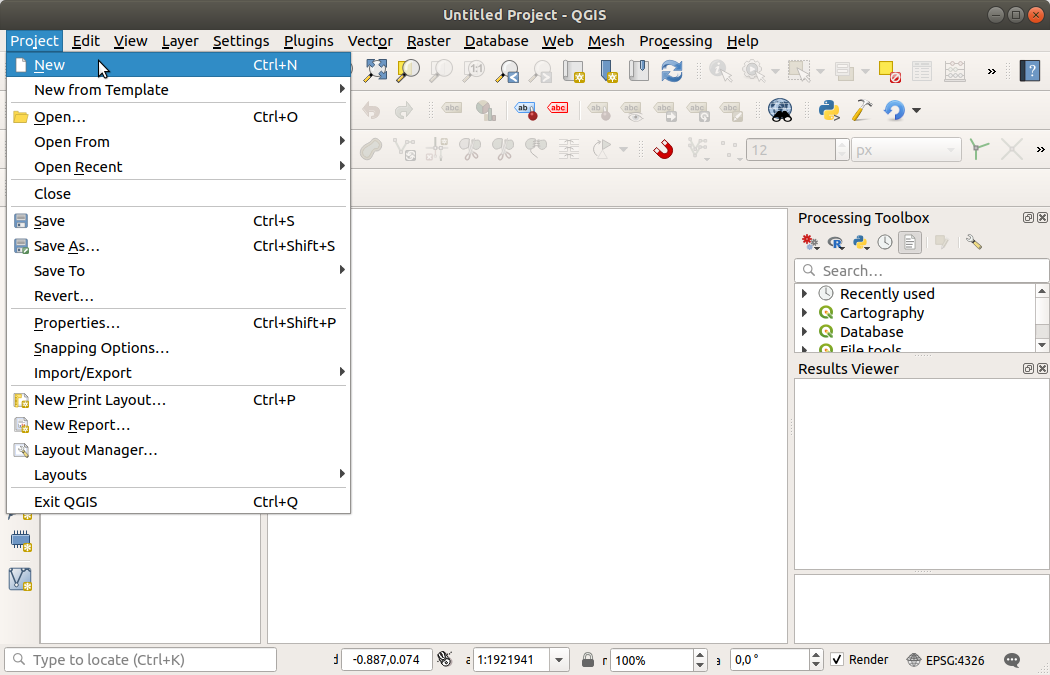
Abb. 6.1 Start eines neuen Projekts in QGIS
In einer Projektdatei sind folgenden Informationen gespeichert:
Hinzugefügte Layer
Welche Layer können abgefragt werden
Layereigenschaften, inklusive Symbologie und Styles
Projektion für das Kartenfenster
Zuletzt gewählte Ausdehnung im Kartenfenster
Drucklayouts
Drucklayout Elemente mit Einstellungen
Drucklayouts Atlas Einstellungen
Digitalisierungseinstellungen
Tabellen Beziehungen
Projekt Makros
Projekt Vorgabestile
Plugin-Einstellungen
QGIS-Servereinstellungen aus der Registerkarte QGIS-Server in den Projekteigenschaften.
Im DB-Manager gespeicherte Abfragen
The project file is saved in XML format (see QGS/QGZ - Das QGIS-Projekt-Dateiformat). This means that it is possible to edit the file outside of QGIS if you know what you are doing. The project file format has been updated several times. Project files from older QGIS versions may not work properly any more.
Bemerkung
By default, QGIS will warn you of version differences.
This behavior is controlled in the General tab of
(
Warn when opening a project file saved with an older
version of QGIS).
Whenever you save a .qgs project file in QGIS, a backup of the
file is created in the same directory as the project file, with the
extension .qgs~.
The extension for QGIS projects is .qgs but when saving from QGIS,
the default is to save using a compressed format with the .qgz
extension.
The .qgs file is embedded in the .qgz file (a zip archive),
together with its associated sqlite database (.qgd) for
auxiliary data.
You can get to these files by unzipping the .qgz file.
Bemerkung
The Auxiliary Storage Properties mechanism makes a zipped project particularly useful, since it embeds auxiliary data.
Projekte können auch über die folgenden Menüeinträge des Projekts in eine PostgreSQL-Datenbank gespeichert bzw. geladen werden:
Both menu items have a sub-menu with a list of extra project storage implementations (PostgreSQL and GeoPackage). Clicking the action will open a dialog to pick a GeoPackage connection and project or a PostgreSQL connection, schema and project.
Projects stored in Geopackage or PostgreSQL can also be loaded through the QGIS browser panel, either by double-clicking them or by dragging them to the map canvas.
6.2. Handling broken file paths
When opening a project, QGIS may fail to reach some data sources due to unavailable service/database, or to a renamed or moved file. QGIS then opens the Handle Unavailable Layers dialog, referencing the unfound layers. You can:
Double-click in the Datasource field, adjust the path of each layer and click Apply changes;
Select a row, press Browse to indicate the correct location and click Apply changes;
Press Auto-Find to browse the folders and try to automatically fix all or selected broken path(s). Be aware that the browsing may take some time.
Ignore the message and open your project with the broken path(s) by clicking Keep Unavailable Layers. Your layer is then displayed in the Layers panel, but without any data until you fix the path using the
 Unavailable layer! icon next to it in the
Layers panel, or Repair Data Source… in the
layer contextual menu.
Unavailable layer! icon next to it in the
Layers panel, or Repair Data Source… in the
layer contextual menu.With the Repair Data Source… tool, once a layer path has been fixed, QGIS scans through all other broken paths and tries to auto-fix those that have the same broken file path.
 Remove Unavailable Layers from the project.
6.3. Ausgaben erzeugen
Es gibt mehrere Möglichkeiten, um Ausgaben aus Ihrer QGIS-Sitzung zu erzeugen. Wir haben das Speichern als Projektdatei bereits in Vorstellung von QGIS-Projekten besprochen. Andere Möglichkeiten, Ausgabedateien zu erzeugen, sind:
Creating images:
 outputs the map canvas
rendering to an image format (PNG, JPG, TIFF…) at custom scale,
resolution, size, …
Georeferencing the image is possible.
See Exporting the map view for more details.
outputs the map canvas
rendering to an image format (PNG, JPG, TIFF…) at custom scale,
resolution, size, …
Georeferencing the image is possible.
See Exporting the map view for more details.Exporting to PDF files: outputs the map canvas rendering to PDF at custom scale, resolution, and with some advanced settings (simplification, georeferencing, …). See Exporting the map view for more details.
Exporting to DXF files: opens a dialog where you can define the ‚Symbology mode‘, the ‚Symbology scale‘ and vector layers you want to export to DXF. Through the ‚Symbology mode‘, symbols from the original QGIS Symbology can be exported with high fidelity (see section Creating new DXF files).
Designing maps:
 opens a dialog where you can
layout and print the current map canvas (see section
Kartenlayout).
opens a dialog where you can
layout and print the current map canvas (see section
Kartenlayout).