중요
번역은 여러분이 참여할 수 있는 커뮤니티 활동입니다. 이 페이지는 현재 91.67% 번역되었습니다.
4. 카탈로그
The QGIS Server Catalog is a simple catalog that shows the list of QGIS projects
served by the QGIS Server. It provides a user-friendly fully
browsable website with basic mapping capabilities to quickly browse the
datasets exposed through those QGIS projects. The catalog can be configured using
the environment variables starting with QGIS_SERVER_LANDING_PAGE (see 환경 변수).
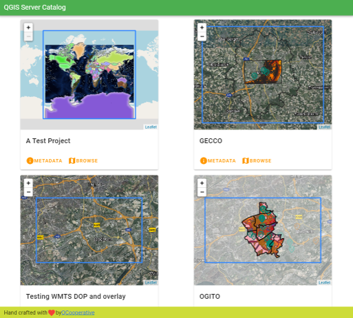
그림 4.3 서버 카탈로그 프로젝트 목록 페이지
프로젝트에 관련된 메타데이터와 프로젝트가 제공하는 서비스를 참고할 수 있습니다. 이런 서비스를 가리키는 링크도 제공됩니다.
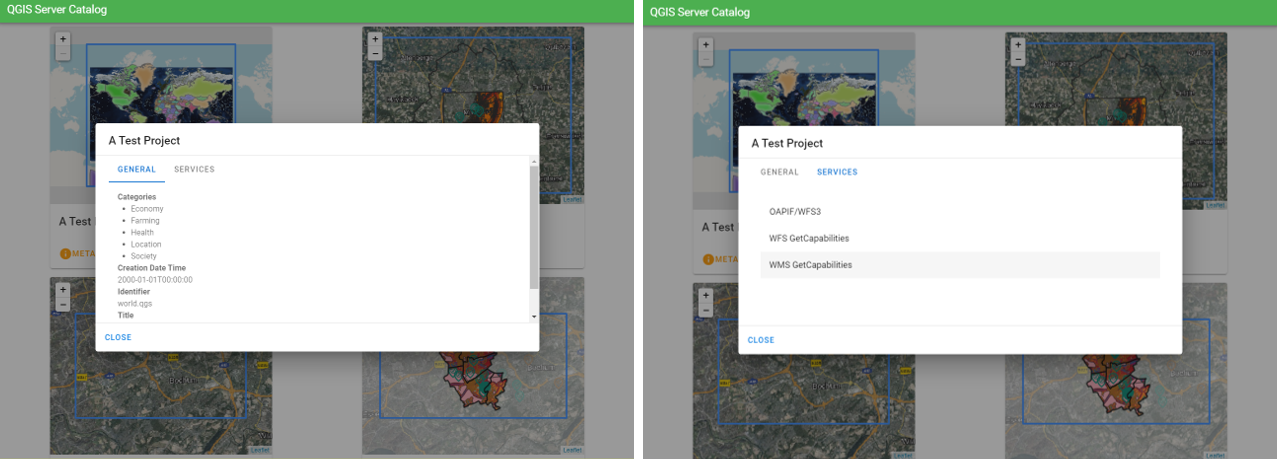
그림 4.4 서버 카탈로그, 프로젝트에 관련된 메타데이터와 프로젝트가 제공하는 서비스(를 가리키는 링크)
프로젝트를 탐색하면 해당 프로젝트가 서비스하는 데이터셋 목록을 볼 수 있습니다.
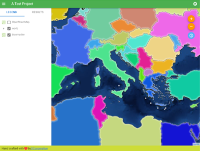
그림 4.5 서버 카탈로그에 있는 프로젝트가 서비스하는 데이터셋 탐색하기
레이어를 오른쪽 클릭하면 해당 레이어 관련 속성 테이블을 표시합니다.
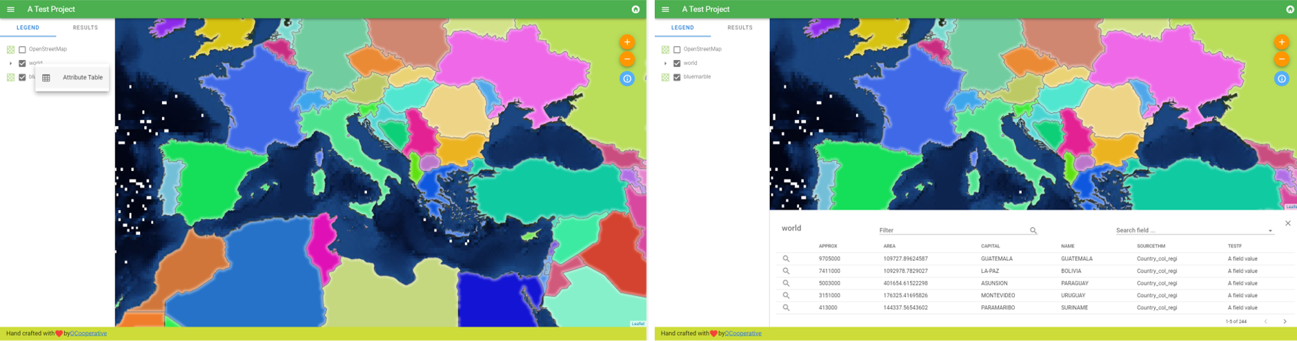
그림 4.6 레이어 관련 속성 테이블
다음 그림에서 볼 수 있는 것처럼, 맵에 있는 요소들의 정보도 참고할 수 있습니다:
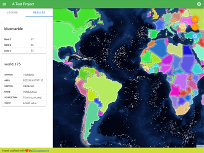
그림 4.7 맵 요소의 정보 참고하기