Important
翻译是一项社区工作:ref:你可以加入<translation_guidelines>。此页面目前翻译进度为 74.42%。
8.2. 课程:结合分析
使用栅格分析的矢量化结果将允许您仅选择适合地形上的建筑。
本课目标: 使用矢量化地形结果选择合适的地块。
8.2.1. ★★☆ 自己试试:
保存当前地图 (
raster_analysis.qgs) 。打开之前在矢量分析期间创建的地图 (您应该将文件保存为
analysis.qgs) 。在 图层 面板,启用以下图层:
hillshade,solution(orbuildings_over_100)
除了这些图层之外 (应该在您之前处理地图时已经加载到地图中),还需要添加
suitable_terrain.shp数据集。如果缺少某些图层,您应该在
exercise_data/residential_development/中找到它们。Use the Intersection tool () to create a new vector layer called
new_solution.shpwhich contains only those buildings which intersect thesuitable_terrainlayer.
现在,您应该有一个显示某些建筑的图层作为解决方案,例如:
8.2.2. ★★☆ 自己试试:检查结果
Look at each of the buildings in your new_solution layer. Compare them
with the suitable_terrain layer by changing the symbology for the
new_solution layer so that it has outlines only. What do you notice
about some of the buildings? Are they all suitable just because they intersect with
the suitable_terrain layer? Why or why not? Which ones would you
deem to be unsuitable?
答案
You may notice that some of the buildings in your new_solution layer
have been "sliced" by the Intersection tool. This shows that only
part of the building - and therefore only part of the property - lies on
suitable terrain. We can therefore sensibly eliminate those buildings from
our dataset.
8.2.3. ★★☆ 自己试试:改进分析
从结果可以看出,其中一些建筑并不真正适合,因此我们现在可以细化分析。
We want to ensure that our analysis returns only those buildings which fall
entirely within the suitable_terrain layer. How would you achieve this?
Use one or more Vector Analysis tools and remember that our buildings are all
over 100m squared in size.
答案
目前,您的分析应该是这样的:
视为一个圆形区域,在所有方向上持续100米。
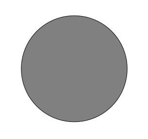
如果它的半径大于100米,那么从它的尺寸 (从各个方向) 减去100米将导致它的一部分留在中间。
Therefore, you can run an interior buffer of 100 meters on your existing
suitable_terrain vector layer. In the output of the buffer
function, whatever remains of the original layer will represent areas where
there is suitable terrain for 100 meters beyond.
例如:
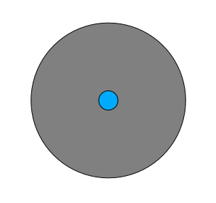
转到 打开缓冲区对话框。
设置如下:
Use the
suitable_terrainlayer with10segments and a buffer distance of-100. (The distance is automatically in meters because your map is using a projected CRS.)在
exercise_data/residential_development/保存输出为suitable_terrain_continuous100m.shp。If necessary, move the new layer above your original
suitable_terrainlayer.您的结果将如下所示:

现在使用 按位置选择 工具 ().
设置如下:
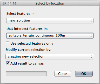
Select features in
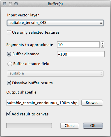
new_solutionthat intersect features insuitable_terrain_continuous100m.shp.结果是:
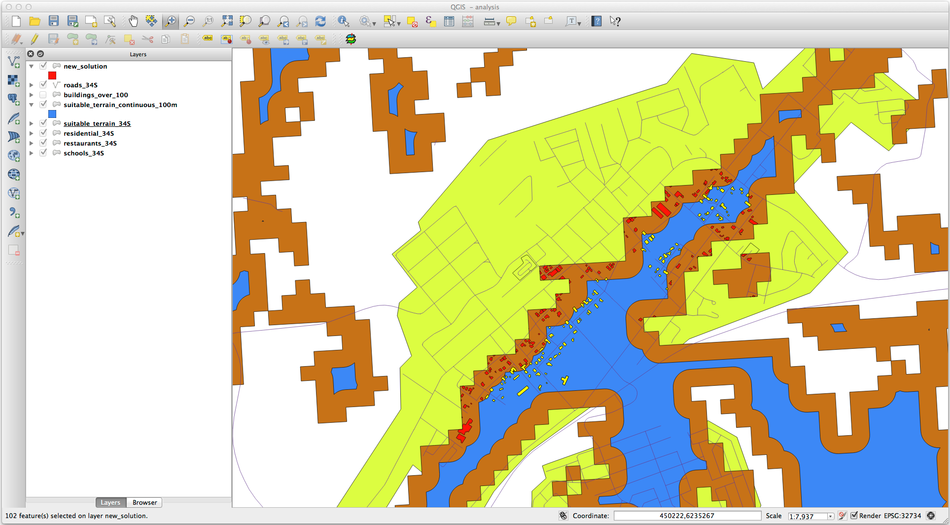
The yellow buildings are selected. Although some of the buildings fall partly outside the new
suitable_terrain_continuous100mlayer, they lie well within the originalsuitable_terrainlayer and therefore meet all of our requirements.将选择保存在
exercise_data/residential_development/为final_answer.shp。
8.2.4. 总结
现在,您已经回答了最初的研究问题,并且可以就开发哪处房产提出建议 (有理由,有分析支持)。
8.2.5. 接下来是?
接下来,您将在第二次作业中展示这些结果。