8.2. Lesson: 分析を組み合わせる
ベクター化されたラスター分析の結果を使用して、適当な地形の上の建物のみを選択することができます。
このレッスンの目標: 適当な小地所を選び出すためにベクター化された地形の結果を使用します。
8.2.1.  Try Yourself
Save your current map (
raster_analysis.qgs).Open the map which you created during the vector analysis earlier (you should have saved the file as
analysis.qgs).In the Layers panel, enable these layers:
hillshade,
solution (または buildings_over_100)
In addition to these layers, which should already be loaded in the map from when you worked on it before, also add the
suitable_terrain.shpdataset.If you are missing some layers, you should find them in
exercise_data/residential_development/Use the Intersection tool () to create a new vector layer called
new_solution.shpwhich contains only those buildings which intersect the suitable_terrain layer.
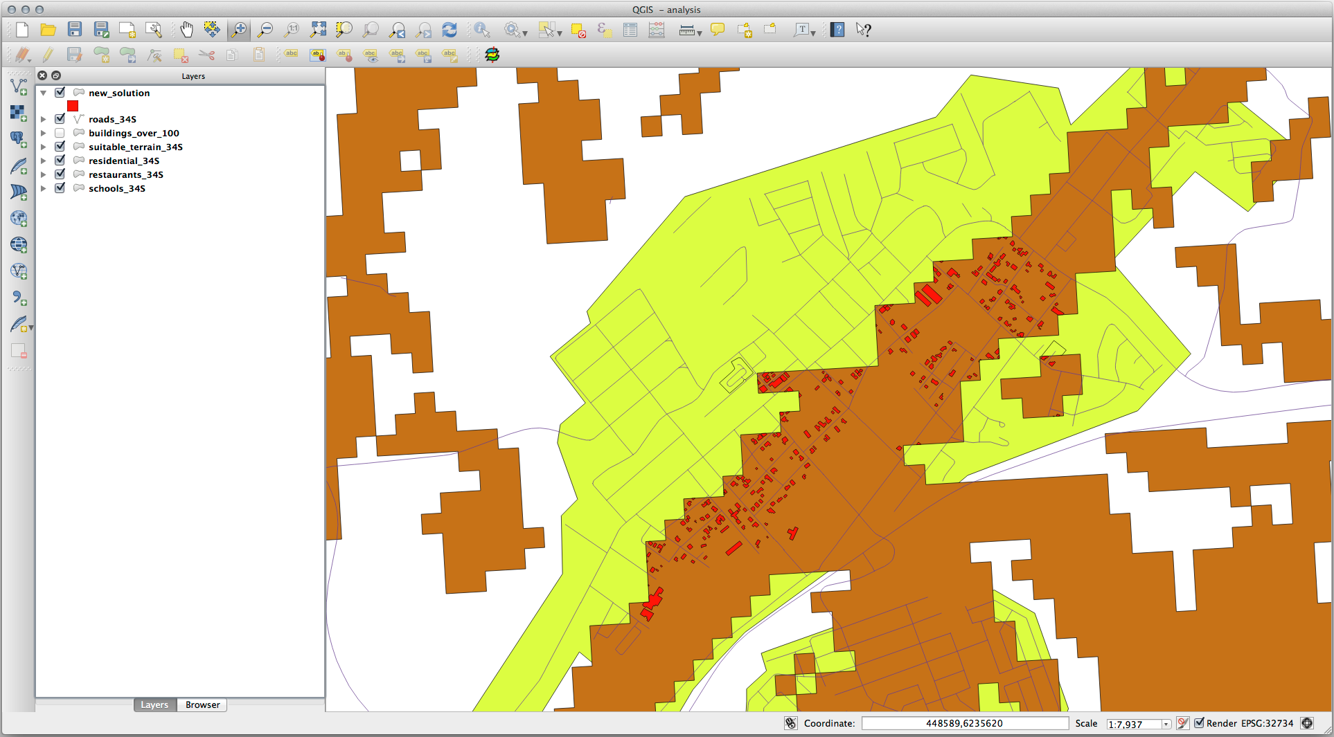
あなたは解として特定の建物を示すレイヤーを持っているはずです。例えば:
8.2.2. Try Yourself 結果の検査
new_solution レイヤーの各建物を見て下さい。 new_solution レイヤーのシンボロジをアウトラインだけに変更して、それらを suitable_terrain レイヤーと比較して下さい。建物のいくつかを見て何に気づきましたか? それらは suitable_terrain レイヤーと交差しているからといってすべて適当ですか? その理由は? どれが不適当だと考えますか?
8.2.3. Try Yourself 分析結果の改良
結果に含まれていた建物の中には本当には適していないものがありましたので分析結果を改良しましょう。
We want to ensure that our analysis returns only those buildings which fall entirely within the suitable_terrain layer. How would you achieve this? Use one or more Vector Analysis tools and remember that our buildings are all over 100m squared in size.
8.2.4. In Conclusion
あなたは当初の研究課題に答え、どの地所を開発するべきかに関する推薦の意見を(無理なく、分析に支えられて)提供できます。
8.2.5. What's Next?
次は2番目の研究課題の一部としてこれらの結果を提示します。