` `
Plugin-ul Instrumentelor GDAL
Ce reprezintă Instrumentele GDAL?
The GDAL Tools plugin offers a GUI to the collection of tools in the Geospatial Data Abstraction Library, http://gdal.osgeo.org . These are raster management tools to query, re-project, warp and merge a wide variety of raster formats. Also included are tools to create a contour (vector) layer, or a shaded relief from a raster DEM, and to make a VRT (Virtual Raster Tile in XML format) from a collection of one or more raster files. These tools are available when the plugin is installed and activated.
Biblioteca GDAL
The GDAL library consists of a set of command line programs, each with a large list of options. Users comfortable with running commands from a terminal may prefer the command line, with access to the full set of options. The GDAL Tools plugin offers an easy interface to the tools, exposing only the most popular options.
Lista Instrumentelor GDAL
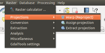
Meniul Instrumentelor GDAL
Proiecții
|
This utility is an image mosaicing, reprojection and warping utility. The program can reproject to any supported projection, and can also apply GCPs stored with the image if the image is “raw” with control information. For more information, you can read on the GDAL website http://www.gdal.org/gdalwarp.html. |
|
This tool allows you to assign projection to rasters that are already georeferenced but miss projection information. Also with its help, it is possible to alter existing projection definitions. Both single file and batch mode are supported. For more information, please visit the utility page at the GDAL site, http://www.gdal.org/gdalwarp.html. |
|
This utility helps you to extract projection information from an input file. If you want to extract projection information from a whole directory, you can use the batch mode. It creates both .prj and .wld files. |


Conversion
|
This program burns vector geometries (points, lines and polygons) into the raster band(s) of a raster image. Vectors are read from OGR-supported vector formats. Note that the vector data must in the same coordinate system as the raster data; on the fly reprojection is not provided. For more information see http://www.gdal.org/gdal_rasterize.html. |
|
Acest utilitar creează poligoanele vectoriale pentru toate regiunile pixelilor din raster, care partajează valoarea unui pixel comun. Fiecare poligon este creat cu un atribut care indică valoarea de pixel a acelui poligon. Utilitarul va crea sursa de date a vectorului de ieșire în cazul în care nu există deja, în mod implicit în formatul ESRI shapefile. Vedeți și http://www.gdal.org/gdal_polygonize.html. |
|
This utility can be used to convert raster data between different formats, potentially performing some operations like subsetting, resampling, and rescaling pixels in the process. For more information you can read on http://www.gdal.org/gdal_translate.html. |
|
Acest utilitar va calcula un tabel optim cu pseudo-culori pentru o imagine RGB dată, folosind un algoritm de decupare mediană pe o histogramă RGB sub-eșantionată. Apoi, transformă imaginea într-una pseudo-colorată, folosind tabelul de culori. Această conversie utilizează oscilațiile Floyd-Steinberg (difuzia erorilor) pentru a maximiza calitatea vizuală a imaginii de ieșire. Utilitarul este descris, de asemenea, în http://www.gdal.org/rgb2pct.html. |
|
Acest utilitar va converti o bandă de pseudoculori, din fișierul de intrare, într-un fișier RGB de ieșire, în formatul dorit. Pentru mai multe informații, consultați http://www.gdal.org/pct2rgb.html. |


Extragere
|
This program generates a vector contour file from the input raster elevation model (DEM). On http://www.gdal.org/gdal_contour.html, you can find more information. |
|
This utility allows you to clip (extract subset) rasters using selected extent or based on mask layer bounds. More information can be found at http://www.gdal.org/gdal_translate.html. |


Analiză
|
This utility removes raster polygons smaller than a provided threshold size (in pixels) and replaces them with the pixel value of the largest neighbor polygon. The result can be written back to the existing raster band, or copied into a new file. For more information, see http://www.gdal.org/gdal_sieve.html. |
|
Acest utilitar va scana o imagine și va încerca să seteze toți pixelii, din jurul marginii, care sunt aproape negri (sau aproape albi) exact la culoarea neagră (sau albă). Acest lucru este adesea folosit pentru a “repara” aerofotogramele comprimate cu pierderi, astfel că pixelii colorați pot fi tratați ca fiind transparenți atunci când are loc mozaicarea. Consultați, de asemenea, http://www.gdal.org/nearblack.html. |
|
This utility fills selected raster regions (usually nodata areas) by interpolation from valid pixels around the edges of the areas. On http://www.gdal.org/gdal_fillnodata.html, you can find more information. |
|
Acest utilitar generează o hartă raster de proximitate, care indică distanța de la centrul fiecărui pixel până la centrul celui mai apropiat pixel, identificat ca pixel țintă. Pixelii țintă sunt aceia din rasterul sursă, pentru care valoarea pixelilor se află în setul de valori al pixelilor țintă. Pentru mai multe informații, consultați http://www.gdal.org/gdal_proximity.html. |
|
This utility creates a regular grid (raster) from the scattered data read from the OGR datasource. Input data will be interpolated to fill grid nodes with values, and you can choose from various interpolation methods. The utility is also described on the GDAL website, http://www.gdal.org/gdal_grid.html. |
|
Tools to analyze and visualize DEMs. It can create a shaded relief, a slope, an aspect, a color relief, a Terrain Ruggedness Index, a Topographic Position Index and a roughness map from any GDAL-supported elevation raster. For more information, see http://www.gdal.org/gdaldem.html. |


Diverse
|
Acest program construiește un VRT (Set de Date Virtual), care reprezintă un mozaic de pe lista rasterelor de intrare acceptate de GDAL. Consultați, de asemenea, http://www.gdal.org/gdalbuildvrt.html. |
|
This utility will automatically mosaic a set of images. All the images must be in the same coordinate system and have a matching number of bands, but they may be overlapping, and at different resolutions. In areas of overlap, the last image will be copied over earlier ones. The utility is also described at http://www.gdal.org/gdal_merge.html. |
|
This utility lists various information about a GDAL-supported raster dataset. On http://www.gdal.org/gdalinfo.html, you can find more information. |
|
The gdaladdo utility can be used to build or rebuild overview images for most supported file formats with one of several downsampling algorithms. For more information, see http://www.gdal.org/gdaladdo.html. |
|
Acest utilitar construiește un fișier shape cu o înregistrare pentru fiecare fișier raster de intrare, un atribut care conține numele fișierului, și o geometrie poligonală care conturează rasterul. Consultați și http://www.gdal.org/gdaltindex.html. |


Setările Instrumentelor GDAL
Utilizați acest dialog pentru a încorpora variabilele GDAL.