` `
Navigatorul Independent QGIS
Browser-ul QGIS este disponibil ca aplicație independentă, dar și ca panou integra în QGIS. Acesta vă permite să navigați cu ușurință prin baza de date geospațială. Puteți avea acces la fișierele vectoriale comune (cum ar fi fișierele shape ESRI sau fișierele MapInfo), bazele de date (ex.: PostGIS, Oracle, Spatialite sau MSSQL Spatial) și conexiunile OWS/WCS|WMS|WFS. Puteți vizualiza, de asemenea, datele GRASS (pentru a aduce datele în QGIS, parcurgeți Integrarea GRASS GIS).
Descrierea Panoului care găzduiește Browser-ul QGIS este disponibilă în secțiunea Panoul Navigatorului, astfel că mai jos este tratat doar navigatorul independent.
Like the Browser panel, the standalone Browser helps you navigate through your filesystem and manage geodata. It also helps you preview or create them and open them in a QGIS project by drag-and-drop.
Startați navigatorul QGIS

 Startați Navigatorul QGIS folosind meniul Start sau scurtăturile de pe desktop.
 Navigatorul QGIS este disponibil din folderul Aplicațiilor dvs.
Navigatorul QGIS ca aplicație desktop
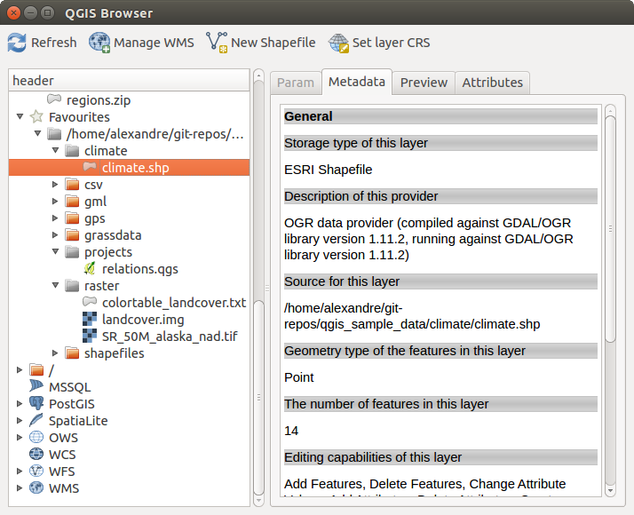
In figure_browser_standalone_metadata, you can see the enhanced functionality of the standalone QGIS Browser. The Param tab provides the details of your connection-based datasets, like PostGIS or MSSQL Spatial. The Metadata tab contains general information about the file (see Metadata Properties). With the Preview tab, you can have a look at your files without importing them into your QGIS project. It’s also possible to preview the attributes of your files in the Attributes tab.