27.1.6. Layer tools
27.1.6.1. Export layer(s) information
Creates a polygon layer with features corresponding to the extent of selected layer(s).
Additional layer details (CRS, provider name, file path, layer name, subset filter, abstract and attribution) are attached as attributes to each feature.
参数
标注 |
名称 |
类型 |
描述 |
|---|---|---|---|
Input layers |
|
[vector: any] [list] |
Input vector layers to get information on. |
Output |
|
[vector: polygon] Default: |
Specification of the output layer with information. One of:
文件编码也可以在此更改。 |
输出
标注 |
名称 |
类型 |
描述 |
|---|---|---|---|
Output |
|
[vector: polygon] |
Polygon vector layer showing extent of input layers and associated information in attributes. |
Python代码
Algorithm ID: native:exportlayersinformation
import processing
processing.run("algorithm_id", {parameter_dictionary})
当你在数据处理工具箱某个算法前悬停时,算法 id 将会展现。*参数字*将会提供参数的名称与数值。参考详见`数据处理_控制台`以获取如何从Python控制台中运行数据处理算法。
27.1.6.2. Export to spreadsheet
Exports the attributes of a selection of vector layers into a spreadsheet document or optionally appends them to an existing spreadsheet as additional sheets.
参数
标注 |
名称 |
类型 |
描述 |
|---|---|---|---|
Input layers |
|
[vector: any] [list] |
Input vector layers. The output spreadsheet will consist of a sheet, for each layer, that contains the attributes of this layer. |
Use field aliases as column headings |
|
[boolean] Default: False |
Use the field aliases from the attribute table for the spreadsheet. |
Export formatted values instead of raw values |
|
[boolean] Default: False |
If |
Overwrite existing spreadsheet |
|
[boolean] Default: True |
If the specified spreadsheet exists, setting this option to |
Destination spreadsheet |
|
[file] 默认: |
Output spreadsheet with a sheet for every layer. One of:
|
输出
标注 |
名称 |
类型 |
描述 |
|---|---|---|---|
Destination spreadsheet |
|
[file] |
Spreadsheet with a sheet for every layer. |
Layers within spreadsheet |
|
[list] |
The list of sheets added to the spreadsheet. |
Python代码
Algorithm ID: native:exporttospreadsheet
import processing
processing.run("algorithm_id", {parameter_dictionary})
当你在数据处理工具箱某个算法前悬停时,算法 id 将会展现。*参数字*将会提供参数的名称与数值。参考详见`数据处理_控制台`以获取如何从Python控制台中运行数据处理算法。
27.1.6.3. Extract layer extent
Generates a vector layer with the minimum bounding box (rectangle with N-S orientation) that covers all the input features.
The output layer contains a single bounding box for the whole input layer.
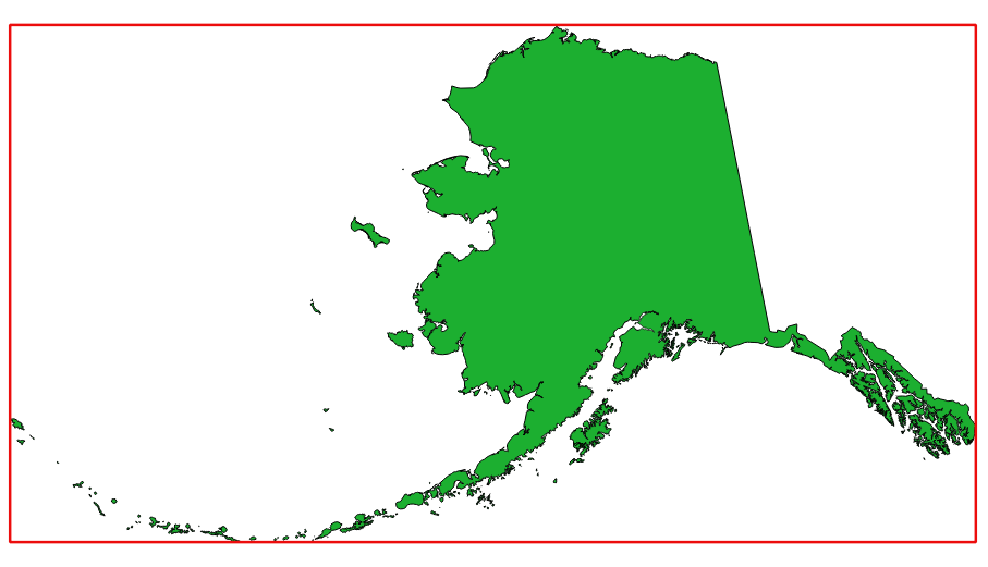
图 27.7 In red the bounding box of the source layer
Default menu:
参数
标注 |
名称 |
类型 |
描述 |
|---|---|---|---|
Layer |
|
[layer] |
Input layer |
Extent |
|
[vector: polygon] Default: |
Specify the polygon vector layer for the output extent. One of:
文件编码也可以在此更改。 |
输出
标注 |
名称 |
类型 |
描述 |
|---|---|---|---|
Extent |
|
[vector: polygon] |
Output (polygon) vector layer with the extent (minimum bounding box) |
Python代码
Algorithm ID: qgis:polygonfromlayerextent
import processing
processing.run("algorithm_id", {parameter_dictionary})
当你在数据处理工具箱某个算法前悬停时,算法 id 将会展现。*参数字*将会提供参数的名称与数值。参考详见`数据处理_控制台`以获取如何从Python控制台中运行数据处理算法。