17. Working with Vector Tiles
17.1. What are Vector Tiles?
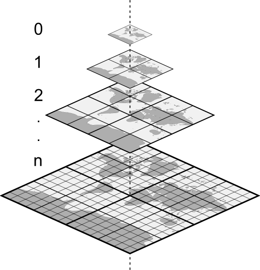
Vector tiles are packets of geographic data, packaged into pre-defined roughly-square shaped „tiles” for transfer over the web. They combine pre-rendered raster map tiles and vector map tiles. The vector tile server returns vector map data, which has been clipped to the boundaries of each tile, instead of a pre-rendered map image. The clipped tiles represent the zoom-levels of the vector tile service, derived from a pyramid approach. Using this structure, the data-transfer is reduced in comparison to un-tiled vector maps. Only data within the current map view, and at the current zoom level need to be transferred. Also, compared to a tiled raster map, data transfer is also greatly reduced, as vector data is typically much smaller than a rendered bitmap. Vector tiles do not have any styling information assigned so QGIS needs to apply a cartographic style in order to display the data.

Fig. 17.1 Pyramid structure of vector tiles with zoom-levels
17.2. Supported Formats
There is support for vector tiles through:
remote sources (HTTP/S) - with XYZ template -
type=xyz&url=http://example.com/{z}/{x}/{y}.pbflocal files - with XYZ template - e.g.
type=xyz&url=file:///path/to/tiles/{z}/{x}/{y}.pbflocal MBTiles database - e.g.
type=mbtiles&url=file:///path/to/file.mbtiles