` `
QGIS Browser
QGIS Browser is available as a standalone application and as a panel in QGIS Desktop. It lets you easily navigate in your filesystem and manage geodata. You can have access to common vector files (e.g., ESRI shapefiles or MapInfo files), databases (e.g., PostGIS, Oracle, SpatiaLite or MS SQL Spatial) and OWS/WCS|WMS|WFS connections. You can also view GRASS data (to get the data into QGIS, see GRASS GIS Integration).
QGIS Browser Panel description is available at The Browser Panel section so only the standalone browser is treated below.
Like the Browser panel, the standalone Browser helps you navigate through your filesystem and manage geodata. It also helps you preview or create them and open them in a QGIS project by drag-and-drop.
Den QGIS Browser starten

 Start the QGIS Browser using the Start menu or desktop shortcut.
 Sie können den QGIS Browser über dem Anwendungen Ordner erreichen.
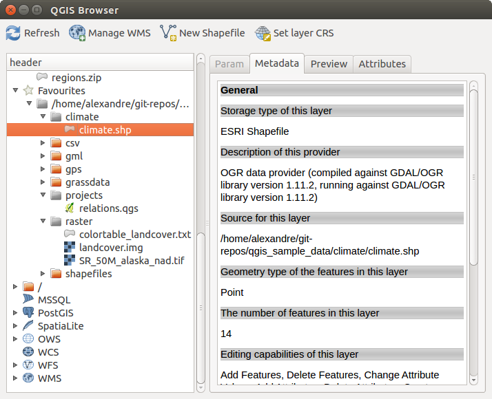
QGIS Browser als eine Stand-Alone-Anwendung
In figure_browser_standalone_metadata können Sie die erweiterte Funktionalität des eigenständigen QGIS Browsers sehen. Der Param Reiter stellt die Details Ihrer verbindungsbasierten Datensätze dar, so PostGIS und räumliche MSSQL. Der Metadata Reiter enthält allgemeine Informationen über die Datei. Mit dem Preview Reiter können Sie einen Blick auf Ihre Dateien machen ohne Sie in Ihr QGIS Projekt zu importieren. Es ist sogar möglich eine Vorschau von den Attributen Ihrer Dateien im Reiter Attribute zu machen.