Layer tools
Extract layer extent
Generates a vector layer with the minimum bounding box (rectangle with N-S orientation) that covers all the input features.
The output layer contains a single bounding box for the whole input layer.
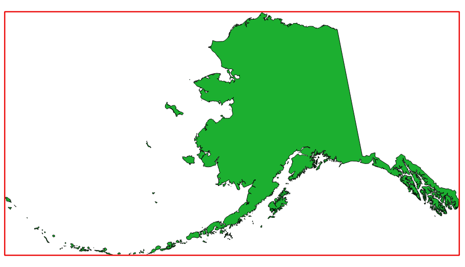
In red the bounding box of the source layer
Default menu:
Parameters
Label |
Name |
Type |
Description |
|---|---|---|---|
Layer |
|
[layer] |
Input layer |
Extent |
|
[vector: polygon] Default: |
Specify the polygon vector layer for the output extent. One of:
The file encoding can also be changed here. |
Outputs
Label |
Name |
Type |
Description |
|---|---|---|---|
Extent |
|
[vector: polygon] |
Output (polygon) vector layer with the extent (minimum bounding box) |