3.1. Basics
This section describes concepts and parameters mutually shared by services. Some of these are standard and defined in OGC specifications while others are very specific to QGIS Server.
Concepts standards :
Concept |
Description |
|---|---|
Nom du service |
|
Nom de la requête |
Concepts propres à QGIS :
Concept |
Description |
|---|---|
Fichier du projet QGIS |
|
Nom du fichier téléchargé |
|
Short name definition |
3.1.1. SERVICE
This standard parameter allows to specify the name of the service to use
for a specific request and has to be formed like
SERVICE=NAME.
URL example for the WMS service:
http://localhost/qgisserver?
SERVICE=WMS
&...
Note
Not available for REST based services like WFS3 (OGC API Features).
3.1.2. REQUEST
This standard parameter allows to specify the name of the request to execute
for a specific service and has to be formed like
REQUEST=RequestName.
URL example for the GetCapabilities request:
http://localhost/qgisserver?
REQUEST=GetCapabilities
&...
Note
Not available for REST based services like WFS3 (OGC API Features).
3.1.3. MAP
This vendor parameter allows to define the QGIS project file to use. It may be
an absolute path or a path relative to the location of the server executable
qgis_mapserv.fcgi. MAP is mandatory by default because a request
needs a QGIS project to actually work. However, the QGIS_PROJECT_FILE
environment variable may be used to define a default QGIS project. In this
specific case, MAP is no longer a required parameter. For further
information you may refer to the Configuration avancée chapter.
Exemple d’URL :
http://localhost/qgisserver?
MAP=/tmp/QGIS-Training-Data/exercise_data/qgis-server-tutorial-data/world.qgs
&...
3.1.4. FILE_NAME
If this vendor parameter is set, the server response will be sent to the client as a file attachment with the specified file name.
URL example to save an XML GetCapabilities document:
http://localhost/qgisserver?
SERVICE=WMS
&REQUEST=GetCapabilities
&FILE_NAME=wms_capabilities.xml
&...
Note
Not available for REST based services like WFS3 (OGC API Features).
3.1.5. Short name
A number of elements have both a short name and a title. The short name is a text string used for machine-to-machine communication while the title is for the benefit of humans. For example, a dataset might have the descriptive title “Maximum Atmospheric Temperature” and be requested using the abbreviated short name “ATMAX”. You can set title, short name and abstract for:
Layers: right-click on a layer and choose .
Groups: right-click on a group and select Set Group WMS data
Project: go to .
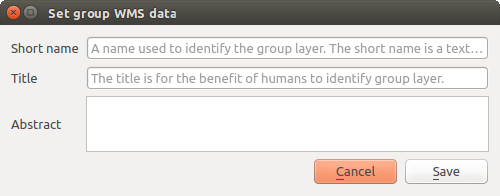
Fig. 3.1 Set group WMS data dialog
Thus, the short name may be used to identify these items when interacting with
QGIS Server. For example with the standard LAYERS parameter:
http://localhost/qgisserver?
SERVICE=WMS
&REQUEST=GetMap
&LAYERS=shortname1,shortname2
&...