Fontos
A fordítás közösségi munka, amihez itt tud csatlakozni. Ennek az oldalnak eddig 99.17%-a van lefordítva.
24.1.9. Rétegeszközök
24.1.9.1. Réteginformációk exportálása
Létrehoz egy poligonréteget, amelynek elemei a kiválasztott réteg(ek) terjedelmének felelnek meg.
További rétegadatok (CRS, szolgáltató neve, fájl elérési útja, réteg neve, részhalmazszűrő, absztrakt és attribútum) minden egyes elemhez attribútumként vannak csatolva.
Paraméterek
Címke |
Név |
Típus |
Leírás |
|---|---|---|---|
Bemeneti rétegek |
|
[réteg] [lista] |
Bemeneti rétegek, amikről információhoz szeretnénk jutni. |
Kimenet |
|
[vector: poligon] Alapértelmezett: |
Az információkkal ellátott kimeneti réteg specifikációja. Egyike ezeknek:
A fájl kódolása is módosítható itt. |
Kimenetek
Címke |
Név |
Típus |
Leírás |
|---|---|---|---|
Kimenet |
|
[vector: poligon] |
Poligon vektorréteg, amely a bemeneti rétegek terjedelmét tartalmazza, és a kapcsolódó információkat az attribútumokban. |
Python kód
**Algoritmus azonosítója **: native:exportlayersinformation
import processing
processing.run("algorithm_id", {parameter_dictionary})
Az algoritmus azonosító akkor jelenik meg, ha az egérmutatót az algoritmus fölé viszi a Feldolgozás eszköztáron. A paraméterszótár tartalmazza a paraméter NAME-eket és érékeket. A feldolgozási algoritmusok Python konzolról történő futtatásával kapcsolatos részletekért lásd a Using processing algorithms from the console fejezetet.
24.1.9.2. Exportálás táblázatkezelőbe
A kiválasztott vektorrétegek attribútumait táblázatkezelő dokumentumba exportálja, vagy opcionálisan hozzáfűzi őket egy meglévő táblázatkezelő dokumentumhoz további lapokként.
Paraméterek
Címke |
Név |
Típus |
Leírás |
|---|---|---|---|
Bemeneti rétegek |
|
[vektor: bármi] [lista] |
Bemeneti vektorrétegek. A kimeneti táblázat rétegenként egy lapból áll, amely a réteg attribútumait tartalmazza. |
Mezőálnevek használata az oszlopfejlécekben |
|
[logikai] Alapértelmezett: Hamis |
Használja a attribútumtáblában szereplő mezőálneveket a táblázatban. |
Formázott értékek exportálása nyers értékek helyett |
|
[logikai] Alapértelmezett: Hamis |
Ha |
Meglévő táblázat felülírása |
|
[logikai] Alapértelmezett: Igaz |
Ha a megadott táblázat létezik, ezt az opciót |
Cél táblázat |
|
[fájl] Alapértelmezett: |
Kimeneti táblázatkezelő fájl, rétegenként egy munkalappal. Ezek egyike:
|
Kimenetek
Címke |
Név |
Típus |
Leírás |
|---|---|---|---|
Cél táblázat |
|
[fájl] |
Táblázat, rétegenként egy munkalappal. |
Rétegek a táblázatban |
|
[lista] |
A táblázathoz hozzáadott munkalapok listája. |
Python kód
Algoritmus azonosítója: native:exporttospreadsheet
import processing
processing.run("algorithm_id", {parameter_dictionary})
Az algoritmus azonosító akkor jelenik meg, ha az egérmutatót az algoritmus fölé viszi a Feldolgozás eszköztáron. A paraméterszótár tartalmazza a paraméter NAME-eket és érékeket. A feldolgozási algoritmusok Python konzolról történő futtatásával kapcsolatos részletekért lásd a Using processing algorithms from the console fejezetet.
24.1.9.3. Rétegterjedelem kinyerése
Egy új vektorréteget hoz létre a bemeneti réteg összes elemét lefedő minimális befoglaló téglalappal (É-D-i tájolású téglalap).
A kimeneti réteg egyetlen befoglaló téglalapot tartalmaz az egész bemeneti réteghez.
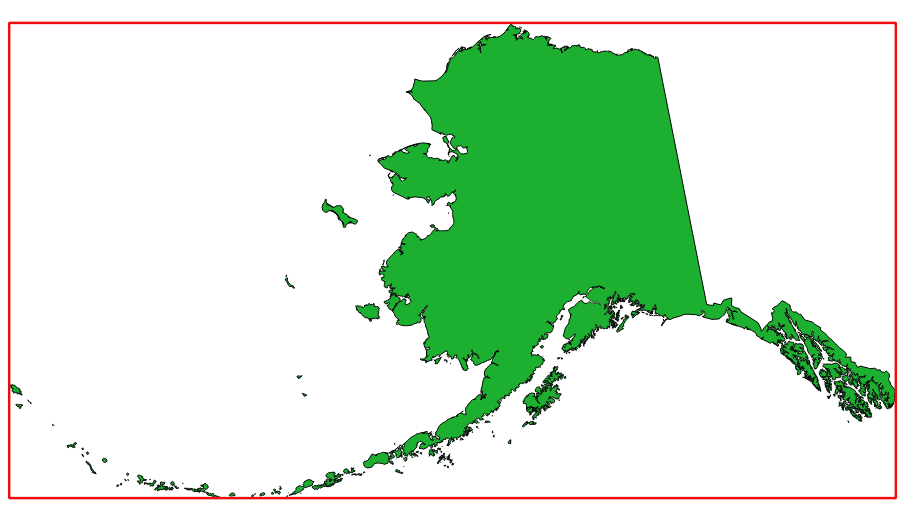
24.29. ábra Pirossal a forrás réteg befoglaló téglalapja
Alapértelmezett menüpont:
Paraméterek
Címke |
Név |
Típus |
Leírás |
|---|---|---|---|
Réteg |
|
[réteg] |
Bemeneti réteg |
Terjedelem |
|
[vector: poligon] Alapértelmezett: |
Határozza meg kimeneti terjedelem vektoros poligonrétegét. Ezek egyike:
A fájl kódolása is módosítható itt. |
Kimenetek
Címke |
Név |
Típus |
Leírás |
|---|---|---|---|
Terjedelem |
|
[vector: poligon] |
A terjedelmet tartalmazó kimeneti (poligon) vektorréteg (minimális befoglaló téglalap) |
Python kód
Algorithm ID: native:polygonfromlayerextent
import processing
processing.run("algorithm_id", {parameter_dictionary})
Az algoritmus azonosító akkor jelenik meg, ha az egérmutatót az algoritmus fölé viszi a Feldolgozás eszköztáron. A paraméterszótár tartalmazza a paraméter NAME-eket és érékeket. A feldolgozási algoritmusok Python konzolról történő futtatásával kapcsolatos részletekért lásd a Using processing algorithms from the console fejezetet.