Svarbu
Vertimas yra bendruomenės pastangos, prie kurių jūs galite prisijungti. Šis puslapis šiuo metu išverstas 53.33%.
26.1. Priedas C: QGIS failų formatai
26.1.1. QGS/QGZ - QGIS projekto failo formatas
QGS formatas yra XML formatas QGIS projektų saugojimui. QGZ formatas yra suspaustas (zip) archyvas, kuriame yra QGS failas ir QGD failas. QGD failas yra susijusi qgis projekto sqlite duomenų bazė, kurioje yra papildomi projekto duomenys. Jei papildomų duomenų nėra, QGD failas bus tuščias.
QGIS faile yra viskas, ko reikia QGIS projekto saugojimui, t.y.:
projekto pavadinimas
projekto CRS
sluoksnių medis
pritraukimo nustatymai
relations
žemėlapio drobės apimtis
projekto modeliai
legend
žemėlapio vaizdo prisegti elementai (2D ir 3D)
sluoksniai su nuorodomis į atitinkamus duomenų rinkinius (duomenų šaltinius) ir kitos sluoksnių savybės, įskaitant apimtį, SRC, jungtis, stilius, braižymą, suliejimo režimą, nepermatomumą ir dar daug kitų dalykų.
projekto savybės
The figures below show the top level tags in a QGS file and the expanded
ProjectLayers tag.
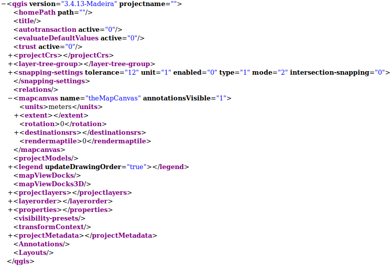
Fig. 26.1 The top level tags in a QGS file
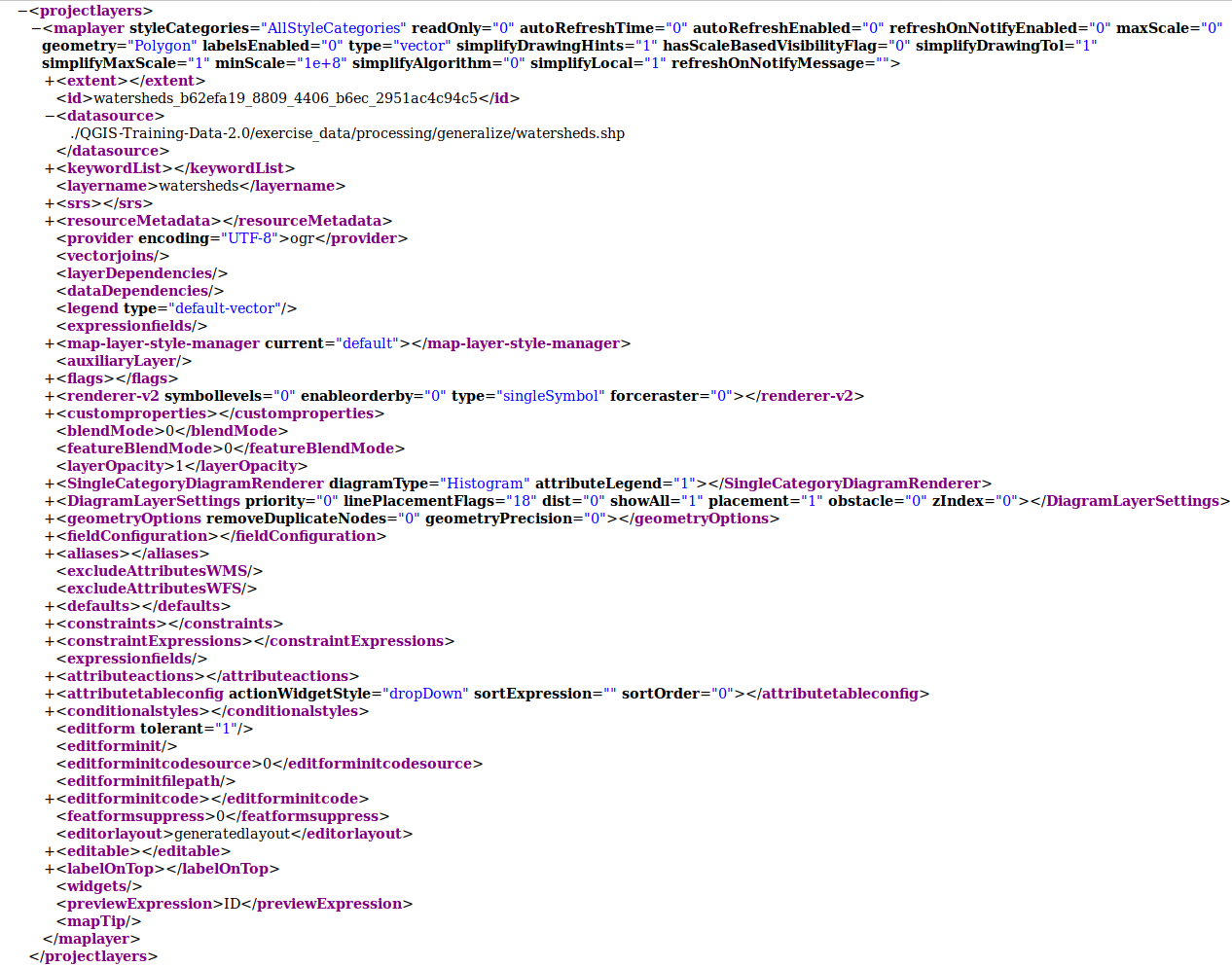
Fig. 26.2 The expanded top level ProjectLayers tag of a QGS file
26.1.2. QLR - The QGIS Layer Definition file
A Layer Definition file (QLR) is an XML file that contains a pointer to the layer data source in addition to QGIS style information for the layer.
The use case for this file is simple: To have a single file for opening a data source and bringing in all the related style information. QLR files also allow you to mask the underlying datasource in an easy to open file.
An example of QLR usage is for opening MS SQL layers. Rather than having to go to the MS SQL connection dialog, connect, select, load and finally style, you can simply add a .qlr file that points to the correct MS SQL layer with all the necessary style included.
In the future a .qlr file may hold a reference to more than one layer.
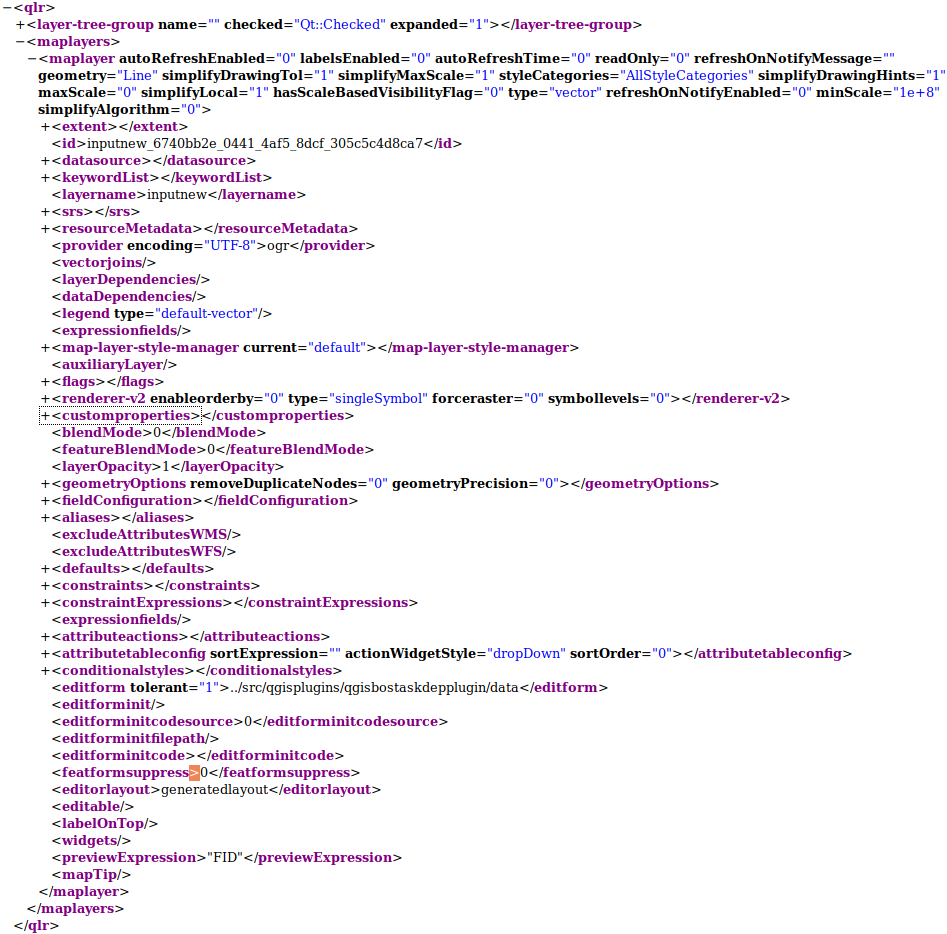
Fig. 26.3 The top level tags of a QLR file
26.1.3. QML - The QGIS Style File Format
QML is an XML format for storing layer styling.
A QML file contains all the information QGIS can handle for the rendering of feature geometries including symbol definitions, sizes and rotations, labelling, opacity and blend mode and more.
The figure below shows the top level tags of a QML file (with
only renderer_v2 and its symbol tag expanded).
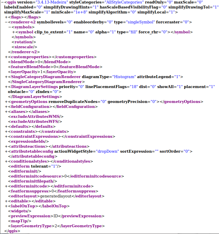
Fig. 26.4 The top level tags of a QML file (only the renderer_v2 tag with its symbol tag is expanded)