18.12. Definirea eextinderilor
Note
În această lecție vom vedea cum se definesc extinderile, acest lucru fiind necesar unor algoritmi, mai ales cele pentru rastere.
Unii algoritmi au nevoie de o extindere, pentru a defini zona care urmează să fie acoperită de analiză și, de obicei, pentru a defini extinderea stratului rezultat.
Atunci când este cerută o anumită extindere, aceasta poate fi definită manual, prin introducerea celor patru valori care o definesc (min X, min Y, max X, max Y), dar există și alte modalități, mai practice și mai interesante, care pot face la fel de bine acest lucru. Vom vedea toate acestea în cadrul lecției.
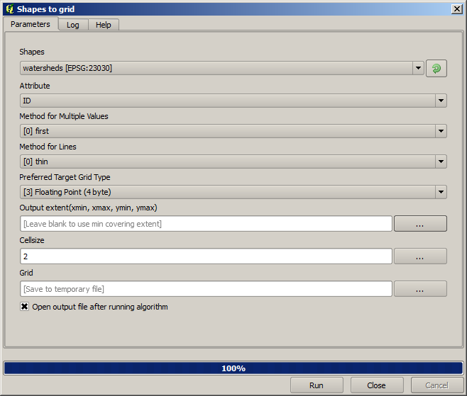
Mai întâi, haideți să deschidem un algoritm care necesită definirea unei extinderi. Deschideți algoritmul de Rasterizare, care creează un strat raster dintr-un strat vectorial.
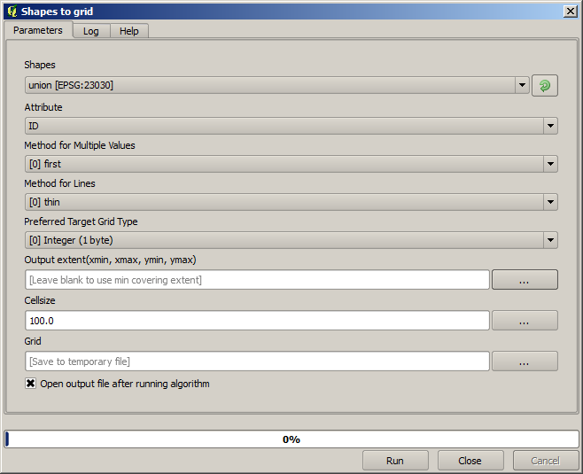
All the parameters, except for the last two ones, are used to define which layer is to be rasterized, and configure how the rasterization process should work. The two last parameters, on the other hand, define the characteristics of the output layer. That means that they define the area that is covered (which is not necessarily the same area covered by the input vector layer), and the resolution/cellsize (which cannot be infered from the vector layer, since vector layers do not have a cellsize).
Primul lucru pe care îl puteți face este să tastați cele 4 valori de definire, prezentate anterior, separate prin virgulă.

That doesn’t need any extra explanation. While this is the most flexible option, it is also the less practical in some cases, and that’s why other options are implemented. To access them, you have to click on the button on the right–hand side of the extent text box.
Să vedem ce poate face fiecare.
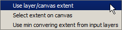
Prima opțiune este Use layer/canvas extent, care va afișa dialogul de selecție de mai jos.
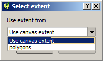
Here you can select the extent of the canvas (the extent covered by the current zoom), or the extension any of the available layers. Select it and click on OK, and the text box will be automatically filled with the corresponding values.
The second option is Select extent on canvas. In this case, the algorithm dialog disappears and you can click and drag on the QGIS canvas to define the desired extent.
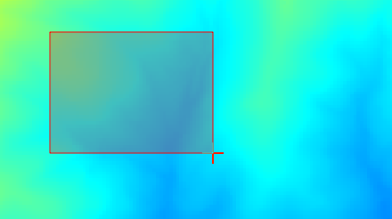
După ce eliberați butonul mouse-ului, dialogul va reapărea iar caseta de text va conține deja valorile corespunzătoare în extinderea definită.
The last option is Use min covering extent from input layers, which is the default option. This will compute the min covering extent of all layers used to run the algorithm, and there is no need to enter any value in the text box. In the case of a single input layer, as in the algorithm we are running, the same extent can be obtained by selecting that same input layer in the Use layer/canvas extent that we already saw. However, when there are several input layers, the min covering extent does not correspond to any of the input layer extent, since it is computed from all of them together.
Vom folosi această ultimă metodă pentru a executa algoritmul nostru de rasterizare.
Completați dialogul parametrilor după cum se arată în continuare, apoi apăsați OK.
Note
In this case, better use an Integer (1 byte) instead of a Floating point (4 byte), since the NAME is an integer with maximum value=64. This will result in a smaller file size and faster computations.
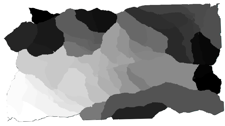
Veți primi un strat raster care acoperă exact zona acoperită de stratul vectorial inițial.
In some cases, the last option, Use min covering extent from input layers, might not be available. This will happen in those algorithm that do not have input layers, but just parameters of other types. In that case, you will have to enter the value manually or use any of the other options.
Notice that, when a selection exist, the extent of the layer is that of the whole set of features, and the selection is not used to compute the extent, even though the rasterization is executed on the selected items only. In that case, you might want to actually create a new layer from the selection, and then use it as input.