2.2. Lesson: Uw eerste laag toevoegen
We zullen de toepassing starten en een basiskaart maken om voor voorbeelden en oefeningen te gebruiken.
Het doel voor deze les: Beginnen met een voorbeeldkaart.
Notitie
Before starting this exercise, QGIS must be installed on your computer. Also, download the training_manual_exercise_data.zip file from the QGIS data downloads area.
Start QGIS met de sneltoets op het bureaublad, menuitem, etc., afhankelijk van hoe u de installatie ervan heeft geconfigureerd.
Notitie
The screenshots for this course were taken in QGIS 2.0 running on MacOS. Depending on your setup, the screens you encounter may well appear somewhat different. However, all the same buttons will still be available, and the instructions will work on any OS. You will need QGIS 2.0 (the latest version at time of writing) to use this course.
Laten we direct gaan beginnen!
2.2.1.  Follow Along: Een kaart voorbereiden
Open QGIS. U zult een nieuwe, blanco kaart hebben.
- Look for the Add Vector Layer button:

- Click on it to open the following dialog:
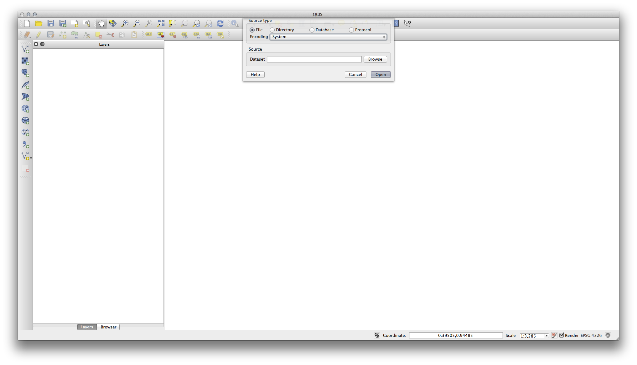
- Click on the Browse button and navigate to the file exercise_data/epsg4326/roads.shp (in your course directory). With this file selected, click Open. You will see the original dialog, but with the file path filled in. Click Open here as well. The data you specified will now load.
Gefeliciteerd! U heeft nu een basiskaart. Het is nu een goed moment om uw werk op te slaan.
Klik op de knop Opslaan als:

- Save the map under exercise_data/ and call it basic_map.qgs.
2.2.2. In Conclusion
U heeft geleerd hoe een laag toe te voegen en een basiskaart te maken!
2.2.3. What’s Next?
Now you’re familiar with the function of the Add Vector Layer button, but what about all the others? How does this interface work? Before we go on with the more involved stuff, let’s first take a good look at the general layout of the QGIS interface. This is the topic of the next lesson.